DAY 9
3/27/26 Friday
Videos on the Website. I’d better start today’s post for my email followers. This trip captures the impressive, massive landscapes the best with videos. So I’ve been posting many more videos than in the past. It’s come to my attention that the videos don’t work from my emailed posts. If you want to see the video visit the blog on the website @ http://www.cinnicrew.com. Select Menu, Van trip- Utah
It’s on a high bank
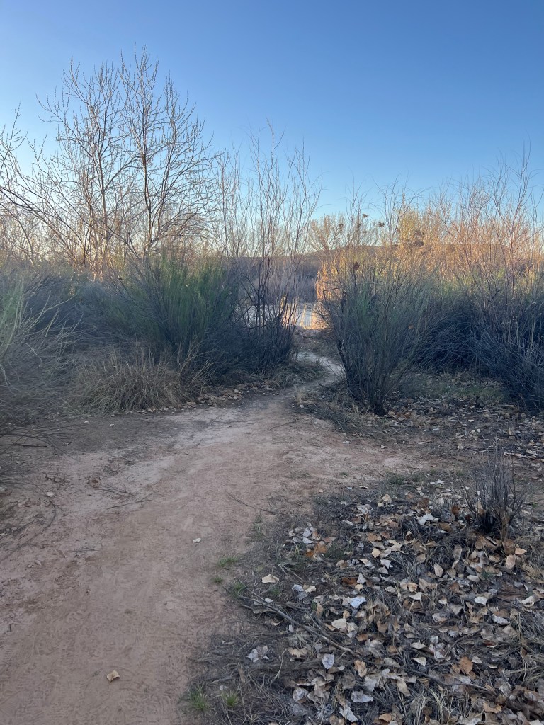
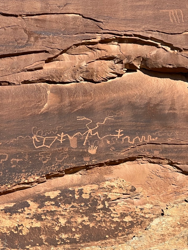
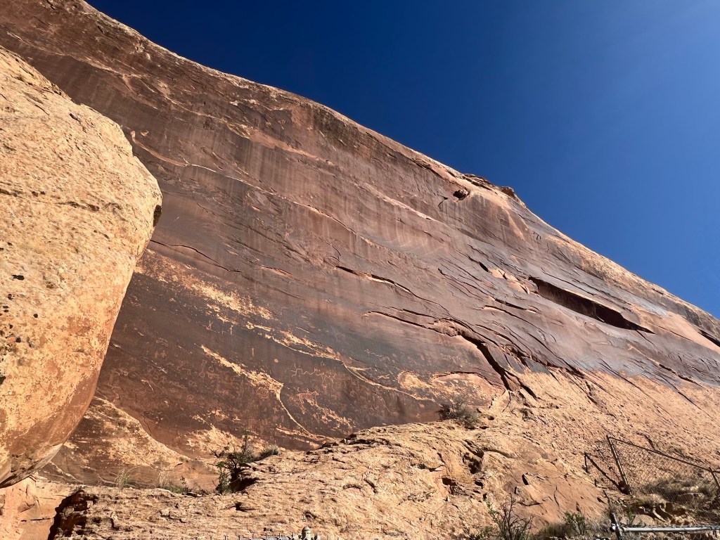
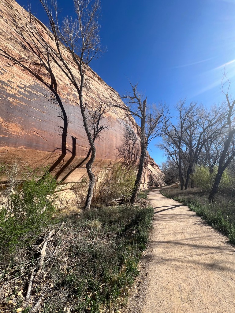
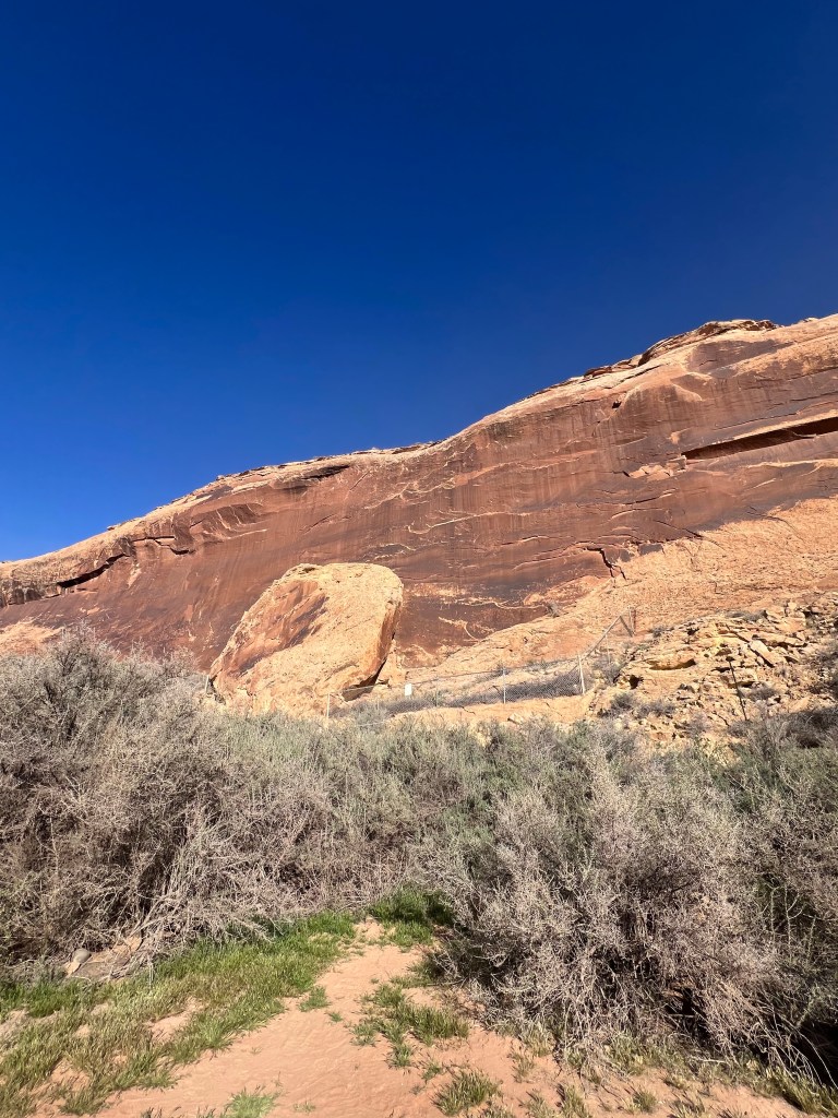
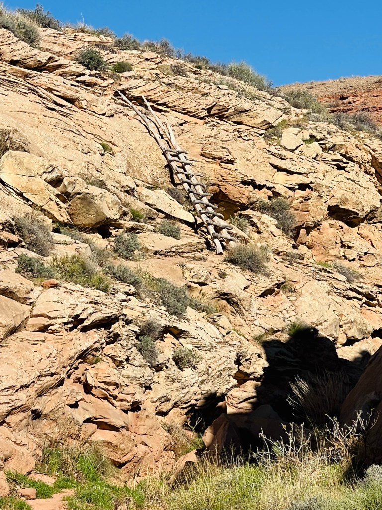
Petroglyph Panels. From camp this morning we walked the short trail that had many petroglyphs marked. There were quite a few and then, sadly, places that had been vandalized before the area was protected.
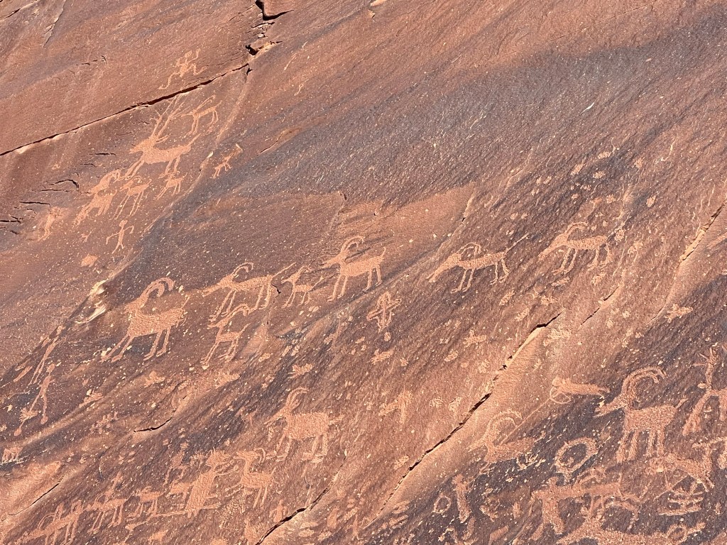
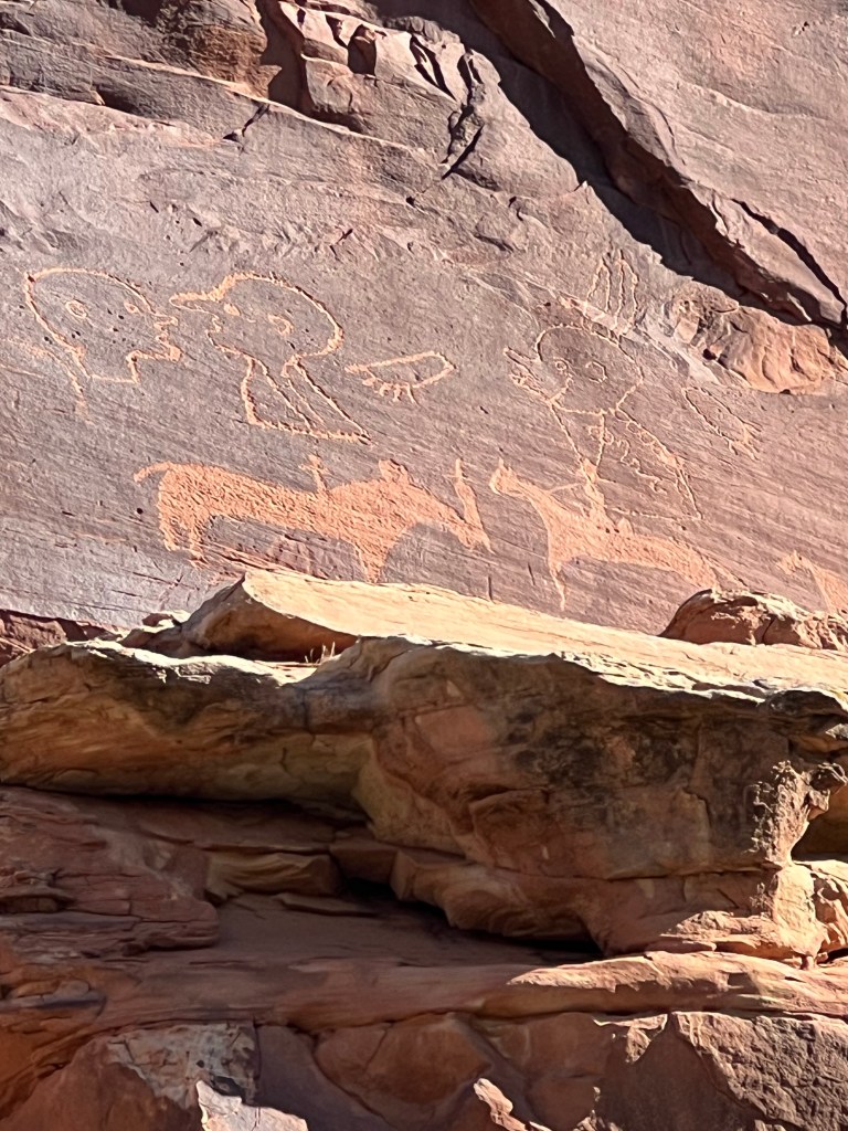
Spanish brought horses to trade.
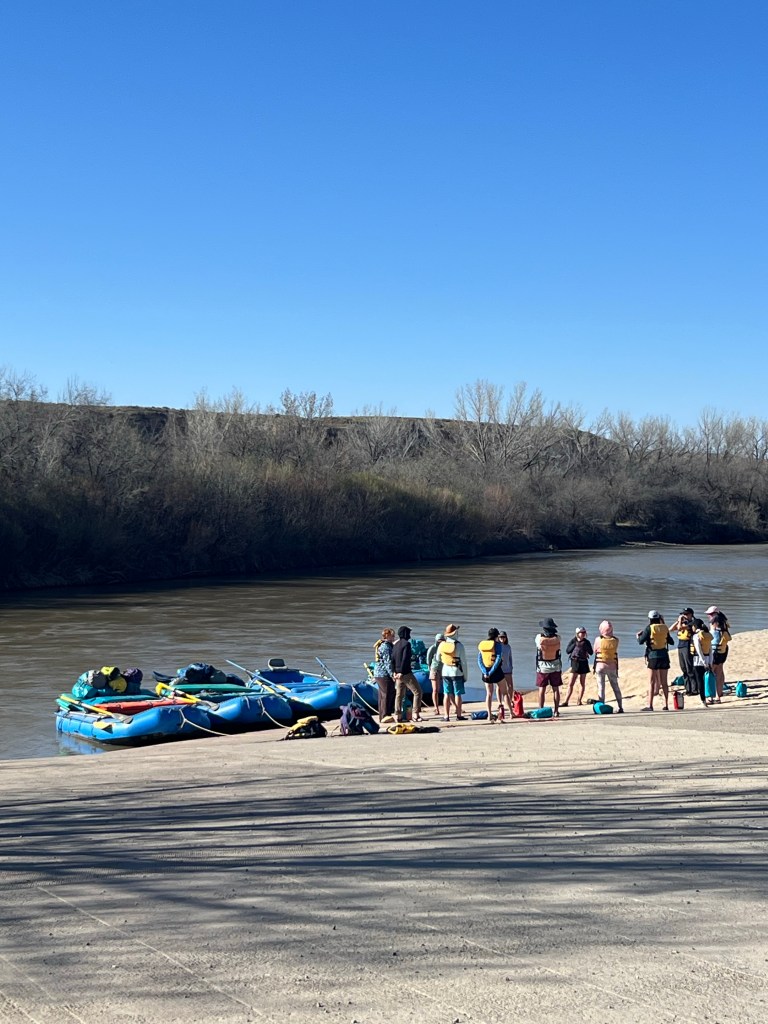
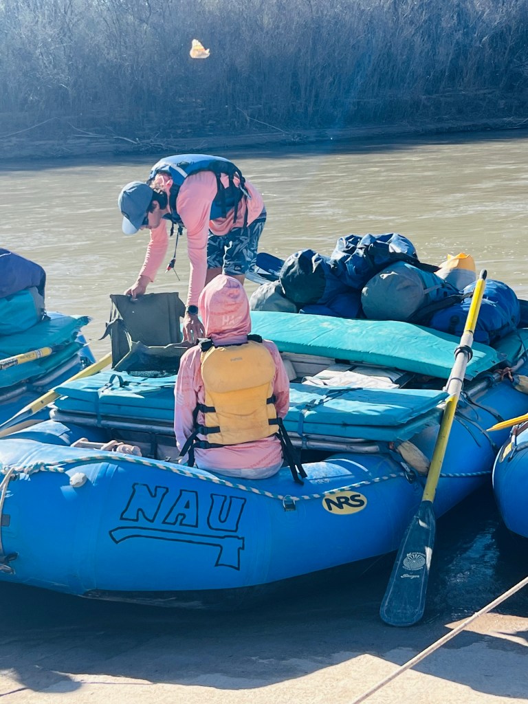
On the walk back to the car there was a young college group from NAU (Northern Arizona University) just embarking on a 3 day rafting trip the San Juan River. We stopped to talk to the guide just before they launched. Our son did this same trip when he was a student at NAU. His was a kayak trip. He loved it… he is a River Rat! More on the San Juan River later in this post.
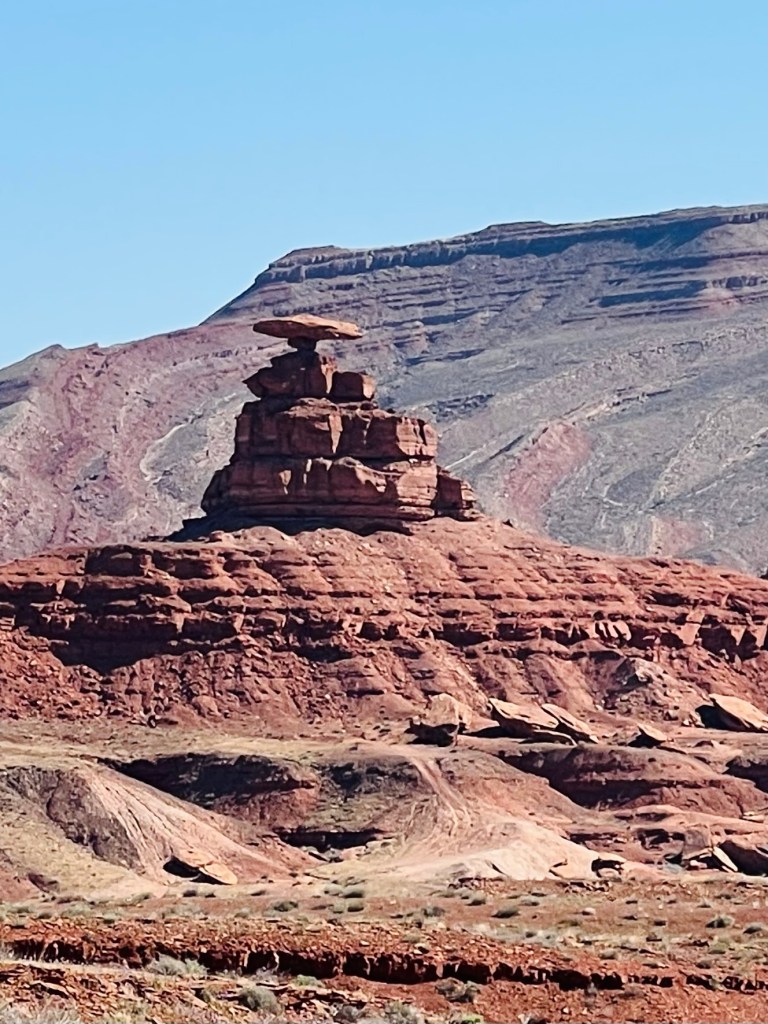
Mexican Hat. Not far ahead was the town of Mexican Hat and the Mexican Hat Rock. It was just three miles off the highway so we took the side trip. Along the route was the rock and further ahead was the town of Mexican Hat. I was curious about the town. Not much to see here. There was a river boat launch, a cafe and a few dilapidated motels. The river drops into a pretty deep canyon at the end of town. There’s an interesting old motel on the steep edge of the canyon cliff. Scary! As I speak of this motel I regret not taking a picture. It was really unique.
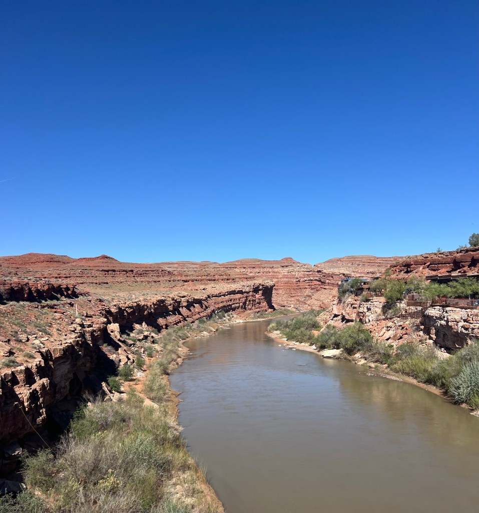
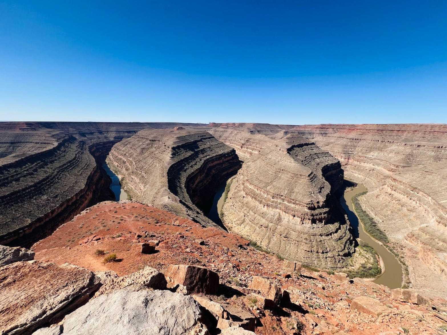
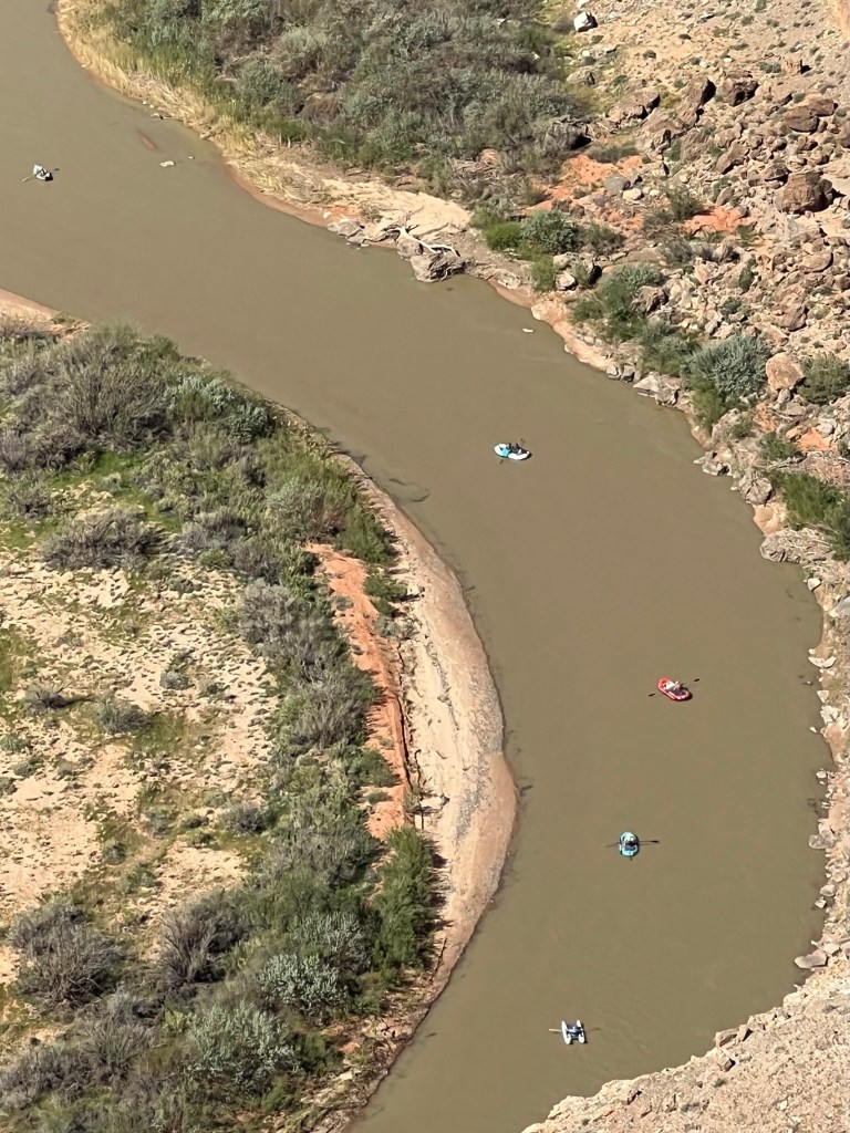
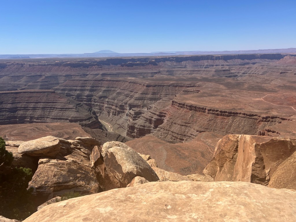
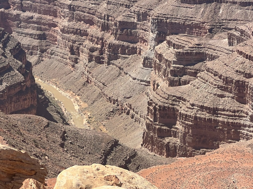
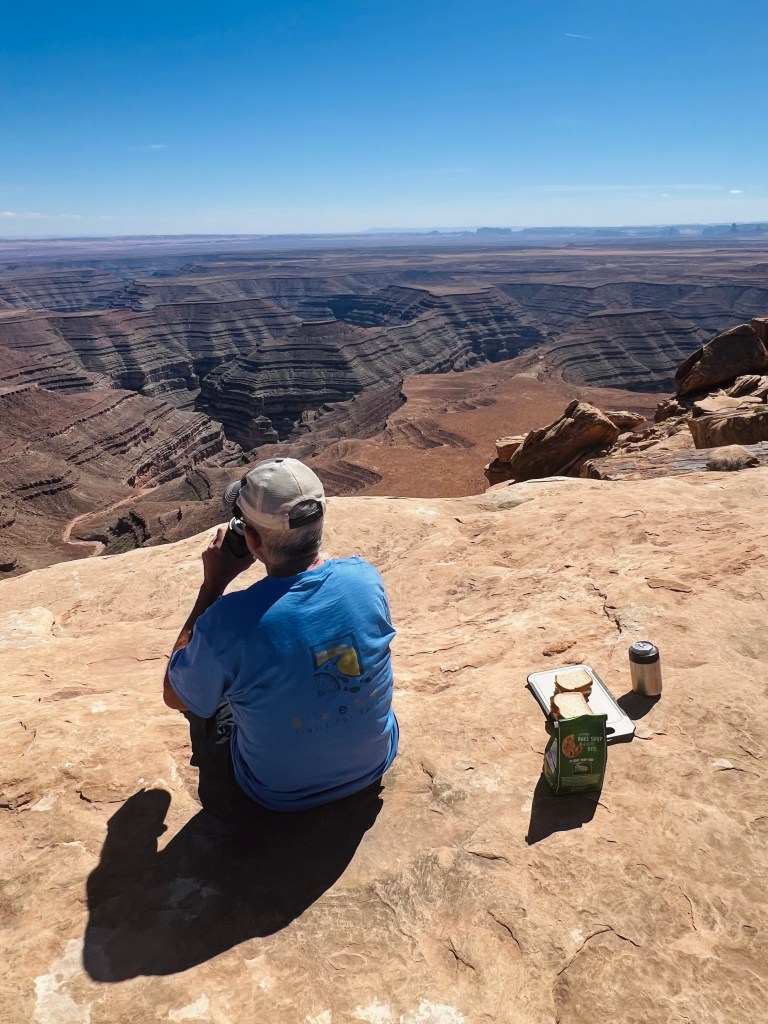
Gooseneck State Park Back onto the main route and headed to the state park. It’s not a big park mainly a big parking lot and small campground on the top edge of Gooseneck Canyon. The view from here of the gooseneck bends in the river is amazing. Far below is the San Juan River. In this stretch 12 miles of the river in the goosenecks covers 5 miles as the crow flies! Today there were 5 rafts coming through below us. We watched them go around the bend and away. I waited until they made the bend so they would show up in the sunlight. We were wondering if it gets windy down there in those tight bends? How beautiful that must be to float through there!

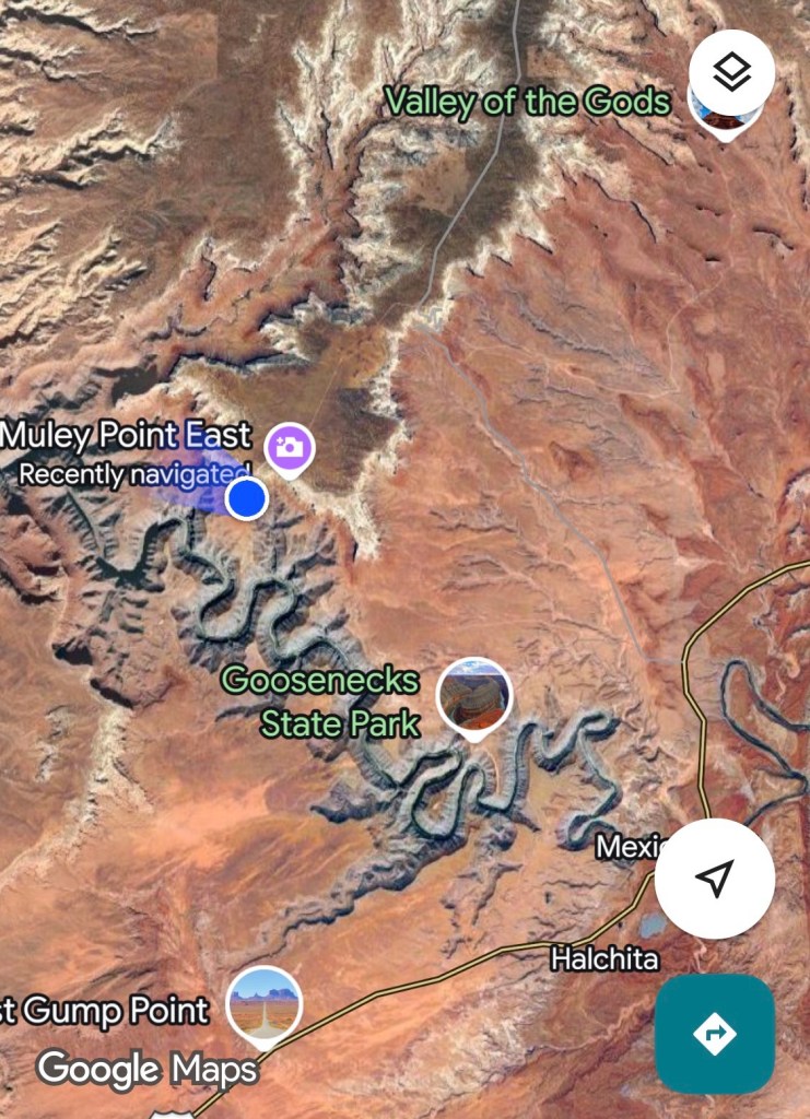
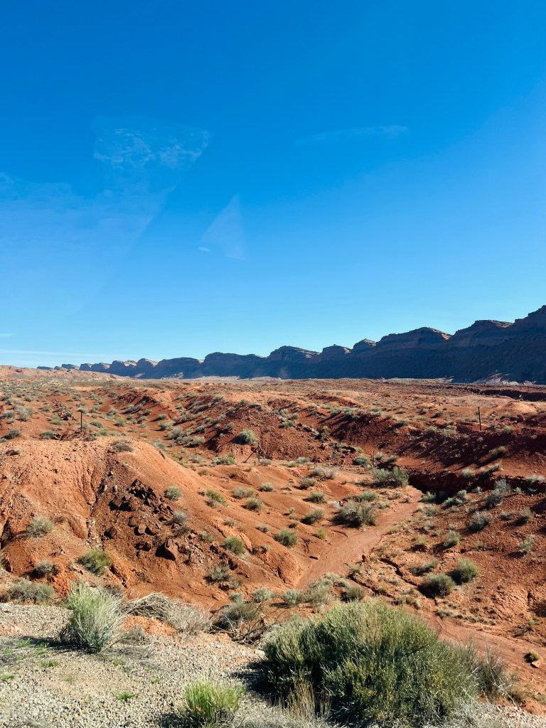
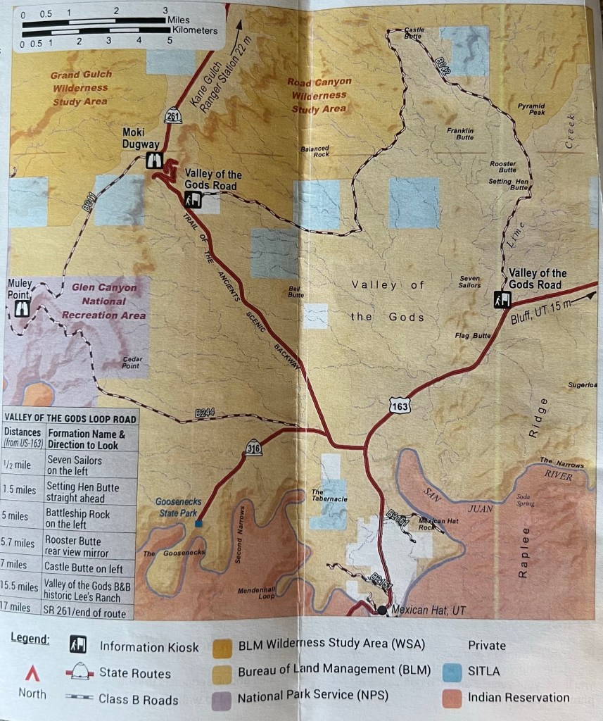
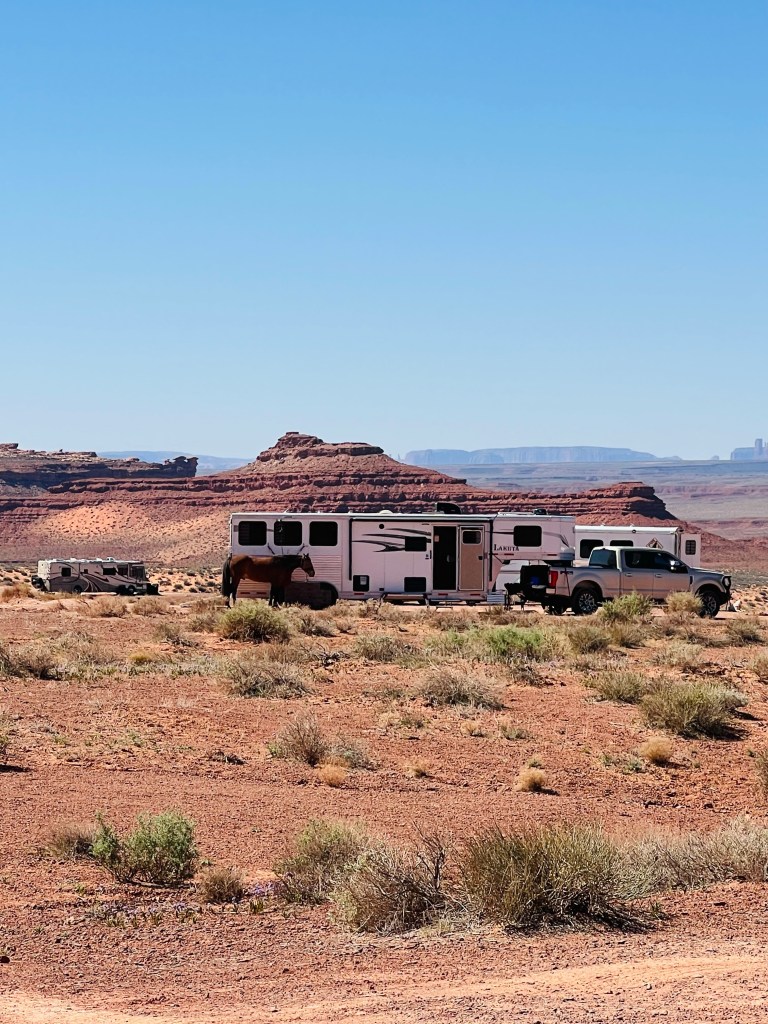
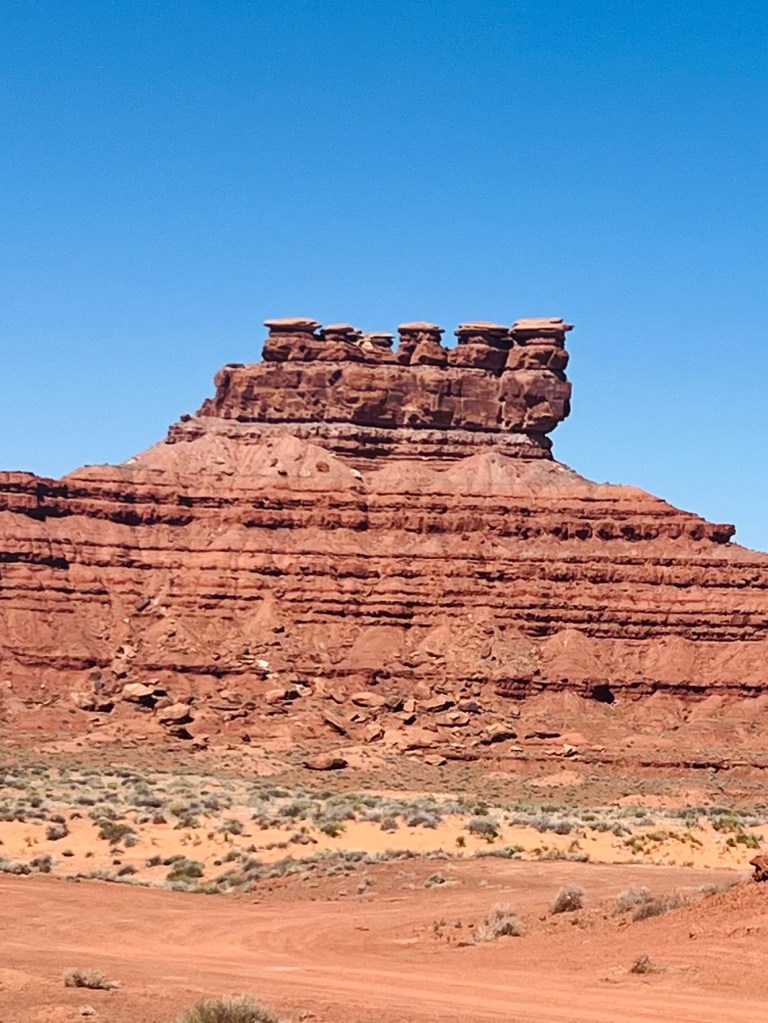
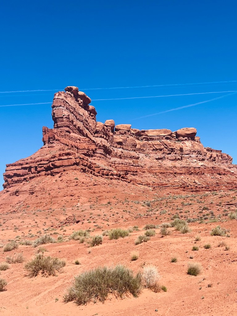
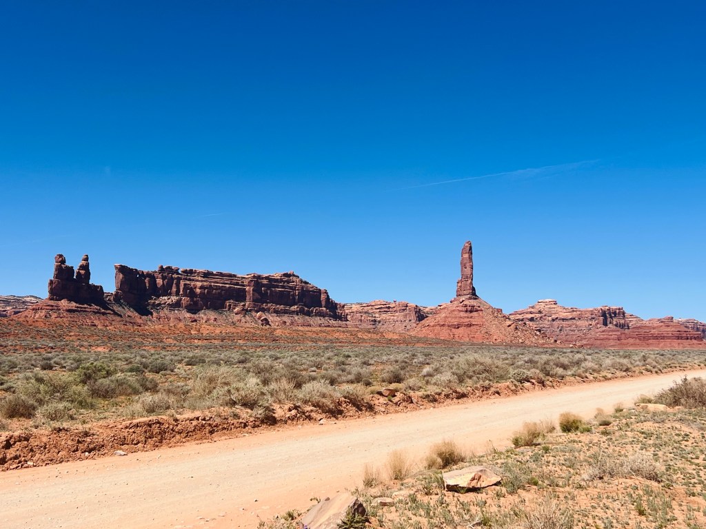
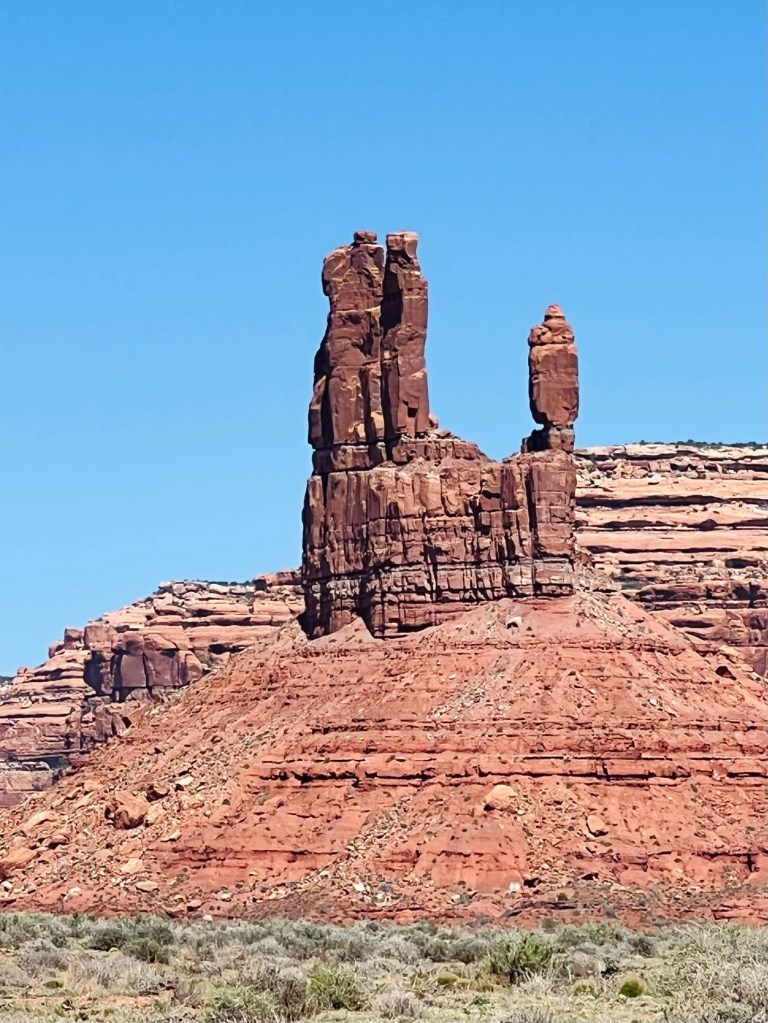
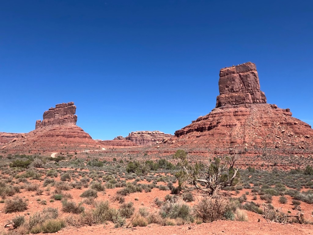
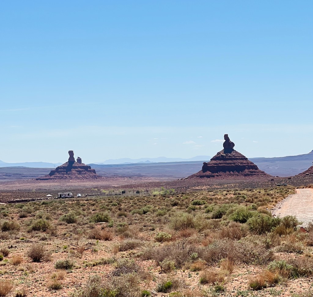
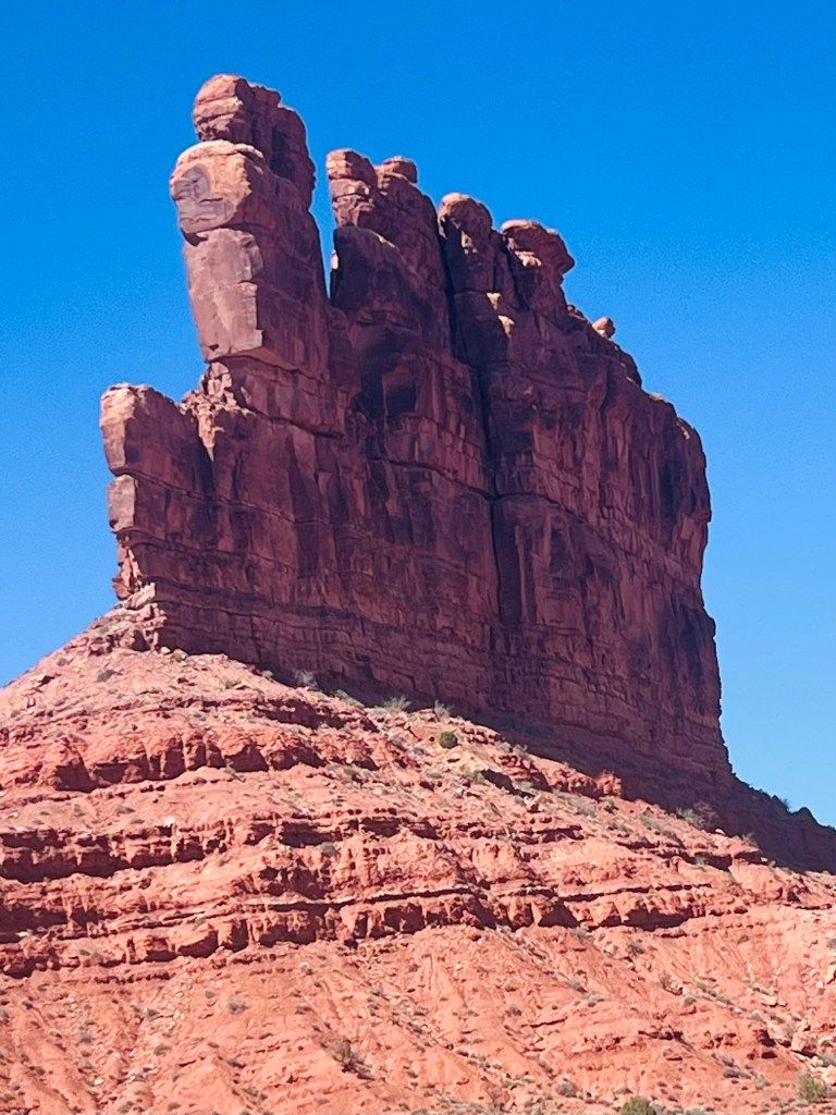
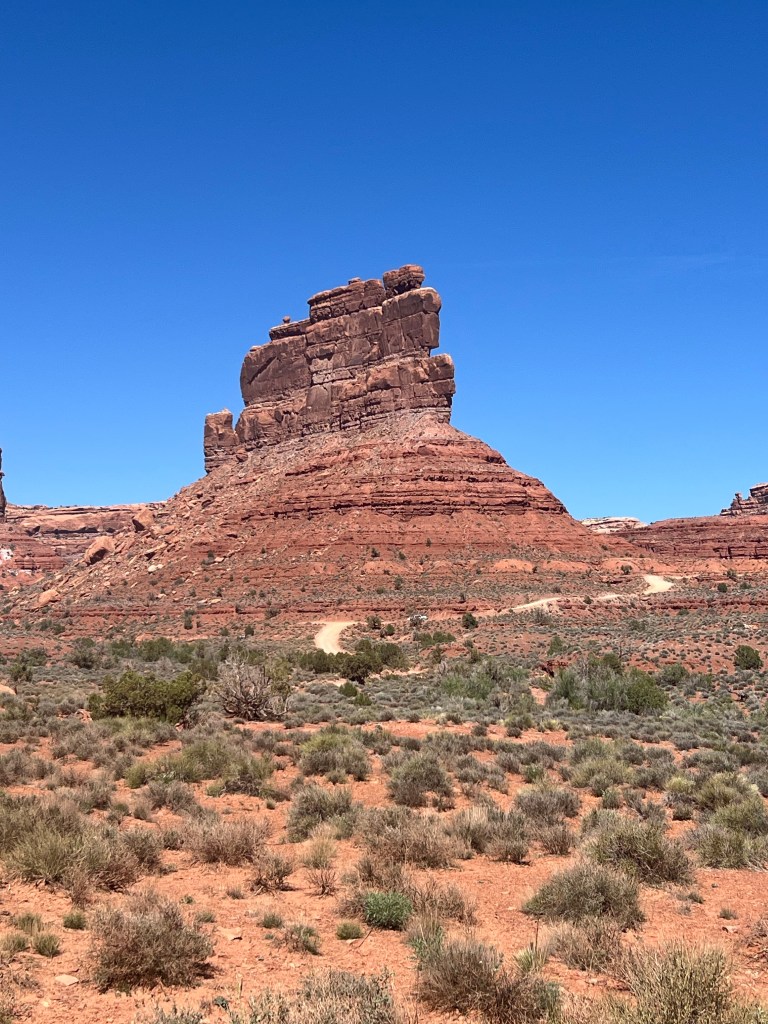
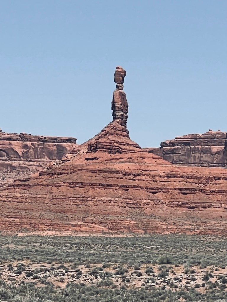
Valley of the Gods. This whole area was in the area called Bears Ears National Monument (BLM). We backtracked a few miles to enter this area. It’s a 17 miles dirt road from end to end.
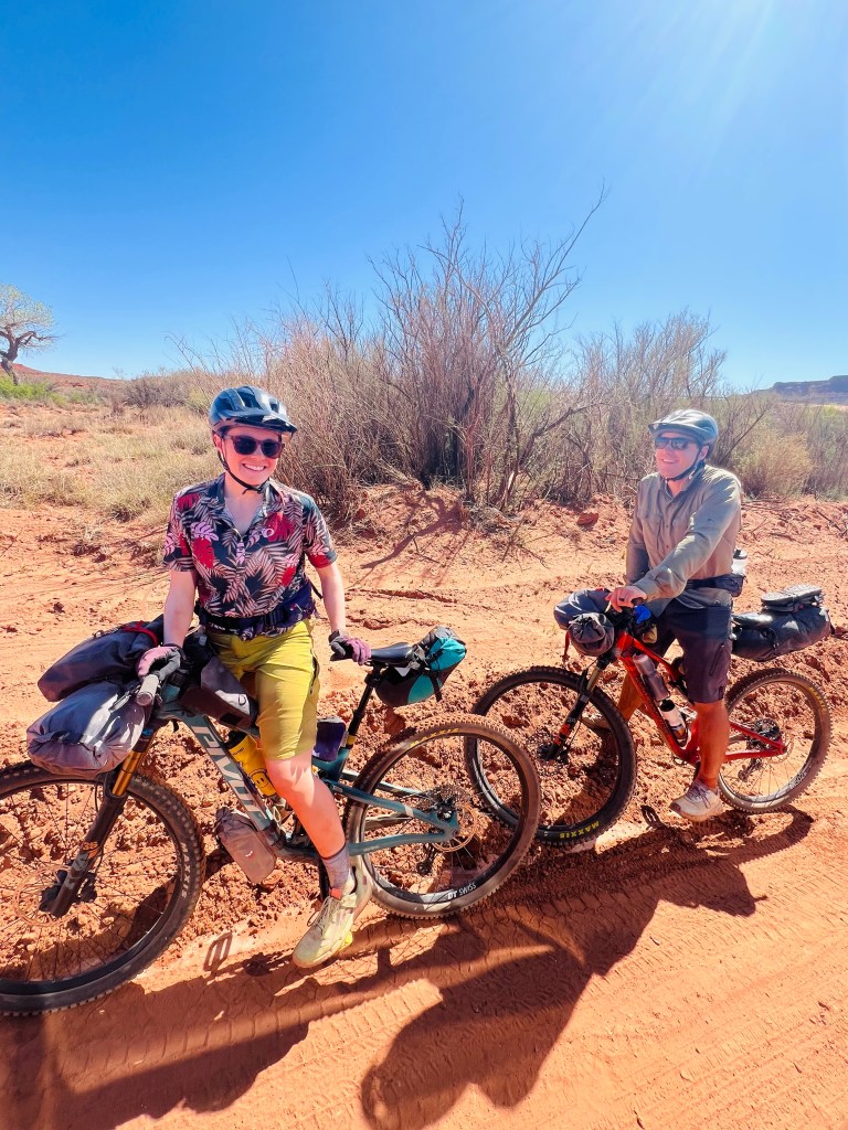
Right at the entry we stopped briefly to visit with a young couple bikepacking who just rode from the highway into the 17 mile route. They looked all set for a big dusty ride. We wished them well. Hope they enjoyed the scenery. It wasn’t busy traffic so they shouldn’t have had to eat too much dust. Not a lot of climbing just dips and rises.
There were lots of dispersed campers along the way. Big RVs, horse trailers, small campers…a variety. The views were impressive! All these rock sculptures with creative names. I wonder who the lucky one was that got to name them? I was never really sure from the map who was who… but I tried to guess by the name.
At one point in the dirt road drive it got very narrow and “technical”. I was glad for Jim’s good driving skills. This was just # 1 driving skill test today. He handled it fine… just me that was nervous. We noticed there weren’t as many campers on the backside of the technical drive pinch point as we were driving out. They probably drive in and out the same way. I didn’t think to take a photo of this feature.
Moki Dugway Road. Driving skill test #2. My heart was in my throat!! We were continuing on the road and it rises up out of the God Valley onto a plateau. After the first switchback the pavement ended and it was sometimes quit narrow, somewhat steep and definitely knife-edge drops off the side. And I thought Going to the Sun Highway in Glacier Park was scary. This was scary too but shorter. Fortunately only one car was coming down when we were going up! Occasionally it was a bit wider or had a bit of a pullout on the switches.
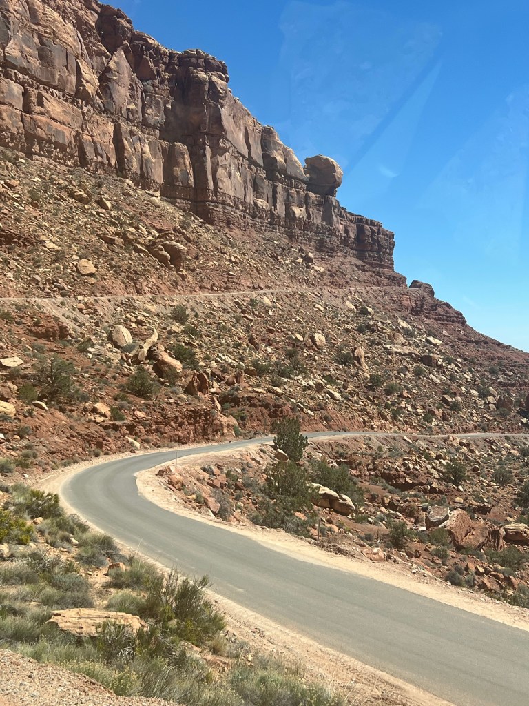
The view looking out and down was immense. Top of the world-ish. They had signs warning the types of vehicles that should not even think about driving this. We made it safe and sound and at the last curve there was enough turnout to get out and take pictures.
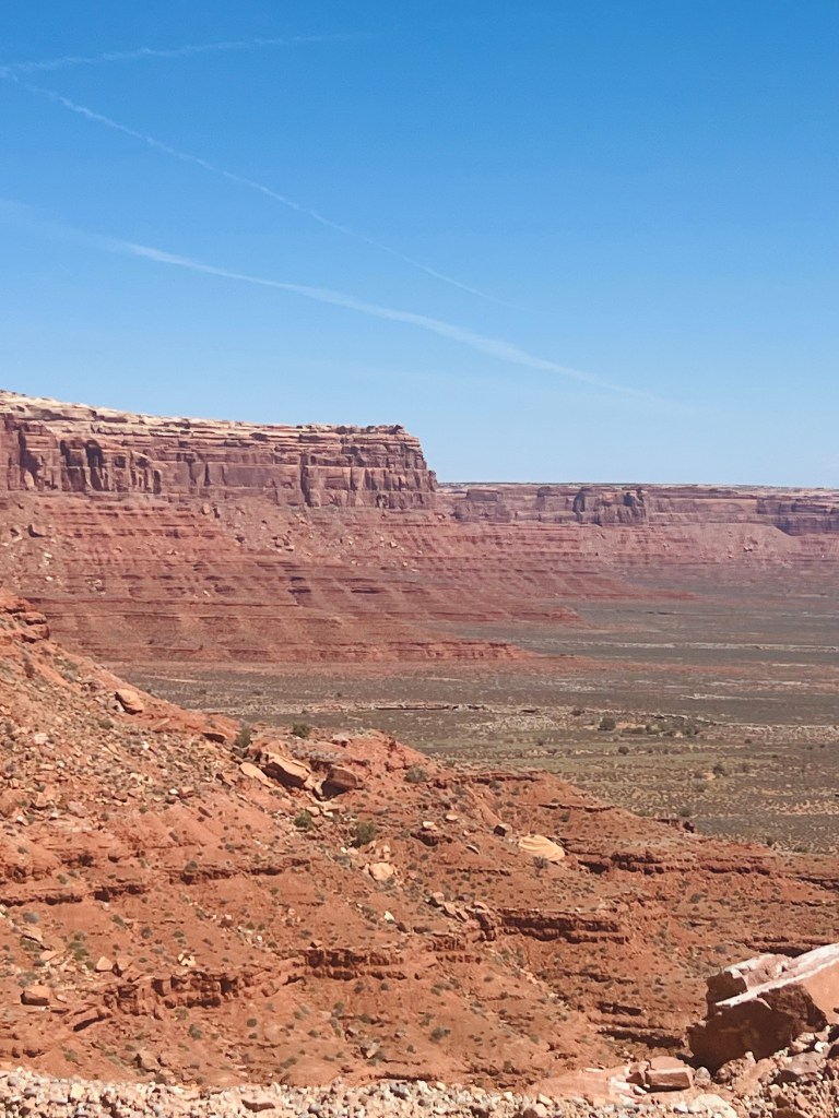
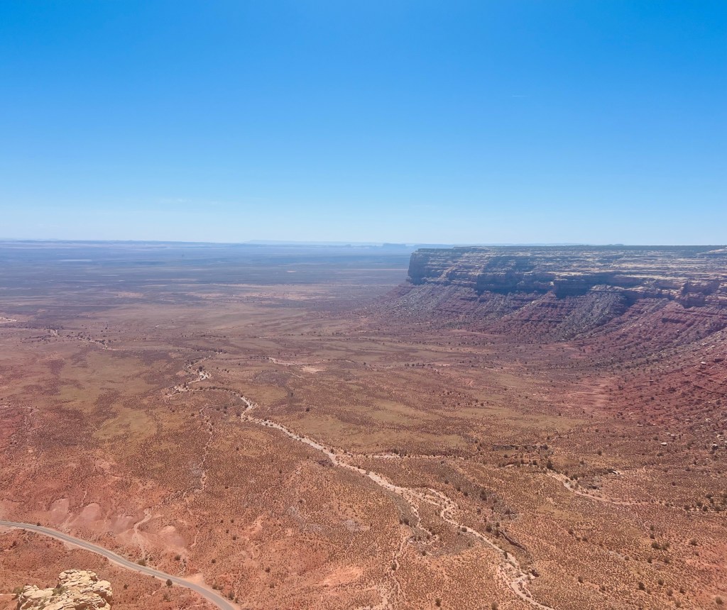
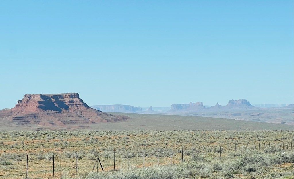
Muley Point. From that driving adventure onto the next short drive down a dirt road to a point overlooking the goosenecks once again and looking south toward Monument Valley on the UT AZ border. This viewpoint was within the Glen Canyon Recreation Area operated by the National Park Service.
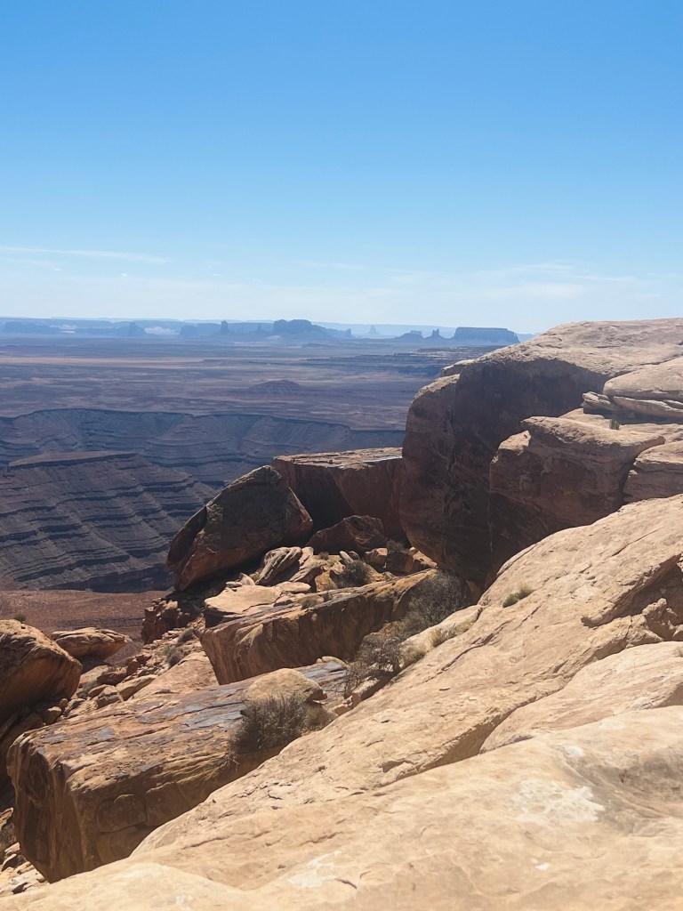
UT/AZ border
Hazy skies the last few days
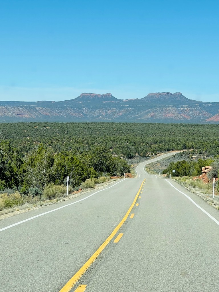
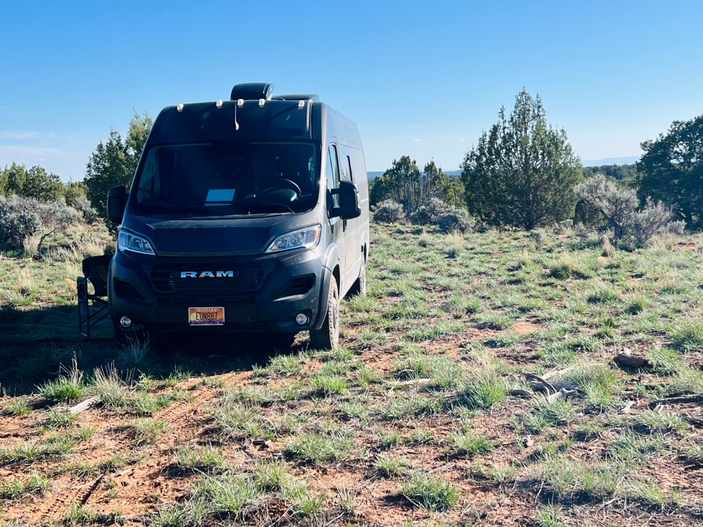
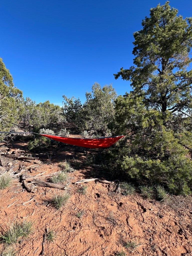
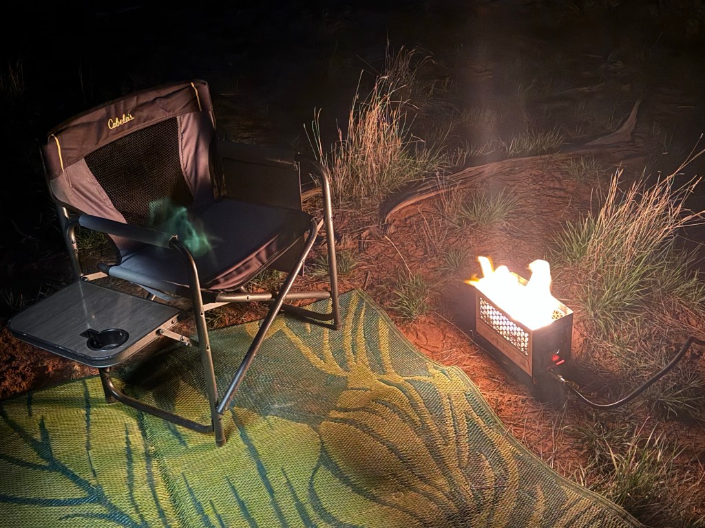
Quiet road to our wild camp spot. Last stretch of the day was heading toward Natural Bridges National Monument… tomorrow’s adventure. Jim had identified a potential wild camp spot (on Ioverlander) so he took the Driving skill #3 test. It was an old jeep trail about 1/2 mile off the highway in the pinyon pines and juniper trees (of course). Just getting off the highway was the scariest part… which Jim later admitted was the trickiest. We do not have a 4X4 Sprinter. Ours is a Ram ProMaster front wheel drive. But we do have new all terrain tires. We found the spot. It’s a lovely quiet flat area to park for the evening. We set up camp (rug, lawn chairs, hammock, ammo can firepit). Enjoyed another couple hours of afternoon, good dinner and campfire with the half moon and stars. The BEST kind of camping. All alone… just nature.
(East Bears Ears and West Bears Ears)
I should mention we are camped in Bears Ears Monument as well. This monument is huge. I recall it being very controversial in Trump 1.0. It conflicts with oil and gas interests in the area. Most of southern Utah was not in favor and I think the size was cut back some but nonetheless it was designated a National Monument.
Government Agencies. We visited a variety of US and State government outdoor area today. Our campground this morning was BLM, then Gooseneck State Park, then BLM National Monuments and National Park Service. How great is it in the USA that we have preserved all this amazing natural beauty and landscapes and made it available for all of its citizens and the world to visit! Our public lands are very important and very special! They should not be sold for private use (my 2 cents)!
Driving Practice for 35+ years! I’m referring to Jim’s career which started in college down here in southern Utah working in Natural Resources for BLM. Then full time in Miles City MT (those are the driving years). He learned how to drive on bad roads in the middle of nowhere. Today he proved it! I hope we don’t find ones that are worse… I’m not ready, nor do I want to go there. I said tonight maybe next time I’ll get out and walk if it’s really scary.., he can drive. But it’s a good adventure so far .
Tomorrow we plan to visit Natural Bridges National Monument by bicycle. About 20 miles including a loop in the monument.
