
DAY 10
3/28/26 Saturday…….No Kings Day!
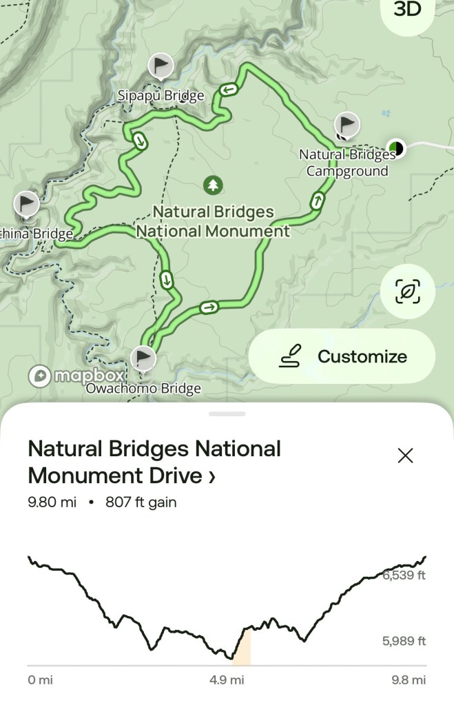
Stats: 17 miles. 1:46 min Speed: 9.9mph. 1207 ft elevation
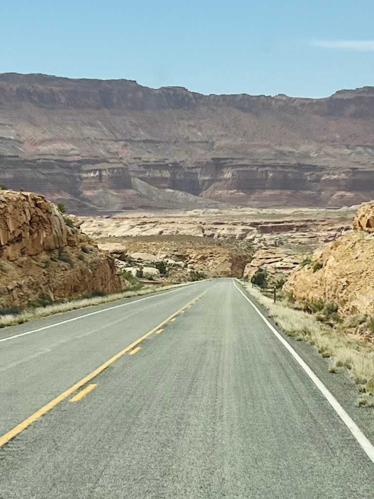
Driving skills test #4. First things first… getting out of our wild camping spot safely. The biggest obstacle was going to be what was the entrance yesterday off the highway. Jim proceeded carefully through the big dip that sloped off to the right (my side!) and then required an uphill for about 5’ onto the highway. We were at a side angle entry. After the dip the right side had a small ledge that stopped us a couple of times but he managed through that. I did get out to talk him through the situation. I stayed out as he made the highway approach. His angle was too high on the first attempt and the high side right wheel literally was 8” off the ground! Yikes… glad I wasn’t inside. We are front wheel drive so obviously no fwd traction He changed the approach angle and the tire stayed on the ground (barely) and had to fight a bit to get traction on the asphalt. He made it and crossed the highway to the proper side. Fortunately there was no traffic at all. Mission accomplished!! I’d prefer a simpler highway access next time, thank you.
Natural Bridges Monument. It was just a few miles down the road to the entrance of Natural Bridges Monument. We parked at a pullout just inside the park to leave the van and ride our bikes. We are at 6600’ elevation. It’s 50 degrees at start and 69 at finish about 4 hrs later.

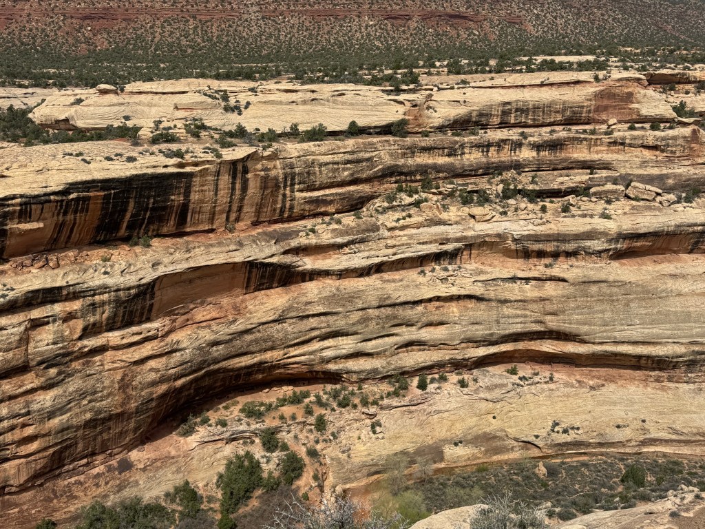
Our route is a one-way loop through the monument. It was so quiet. It’s off season for this area…even the visitor center was closed for training. A handful of cars at best so we enjoyed almost being alone in the road. Speed limit was pretty slow. (25-35).
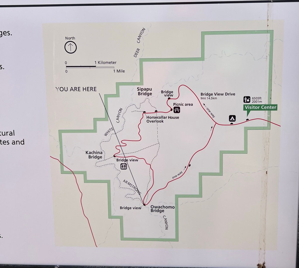
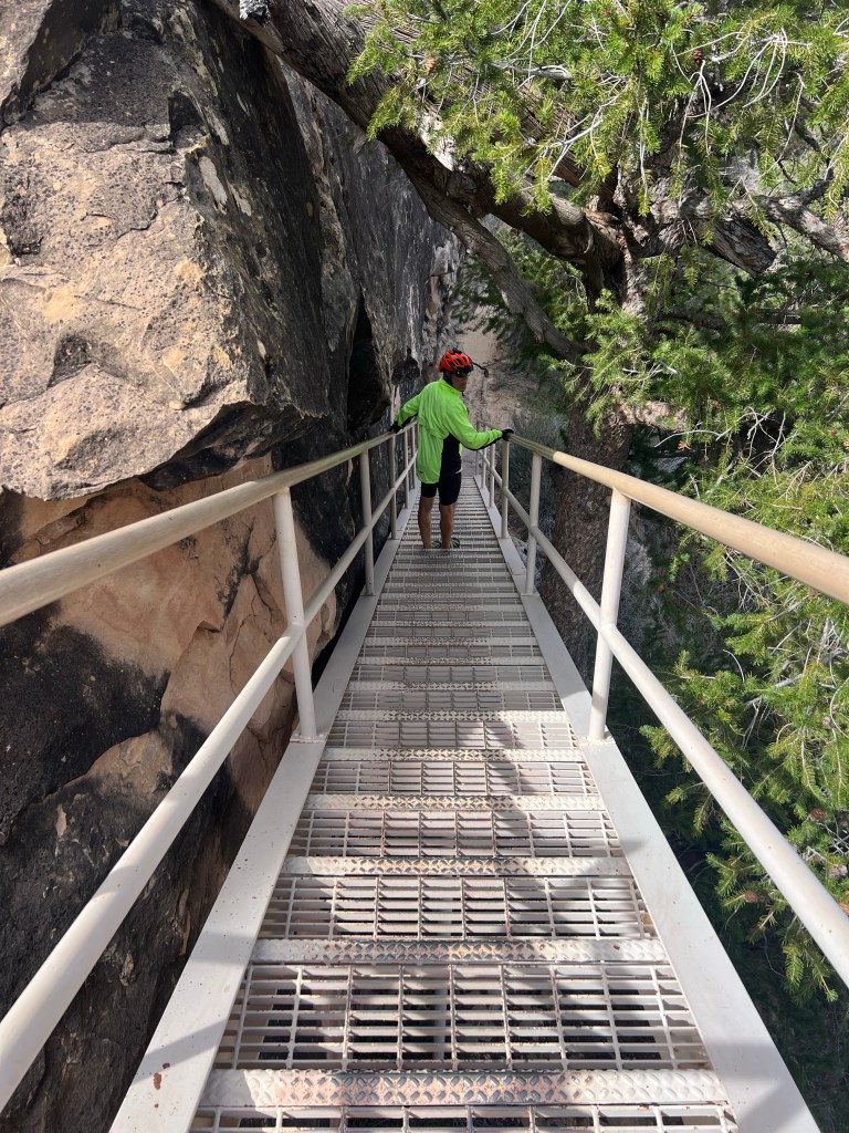
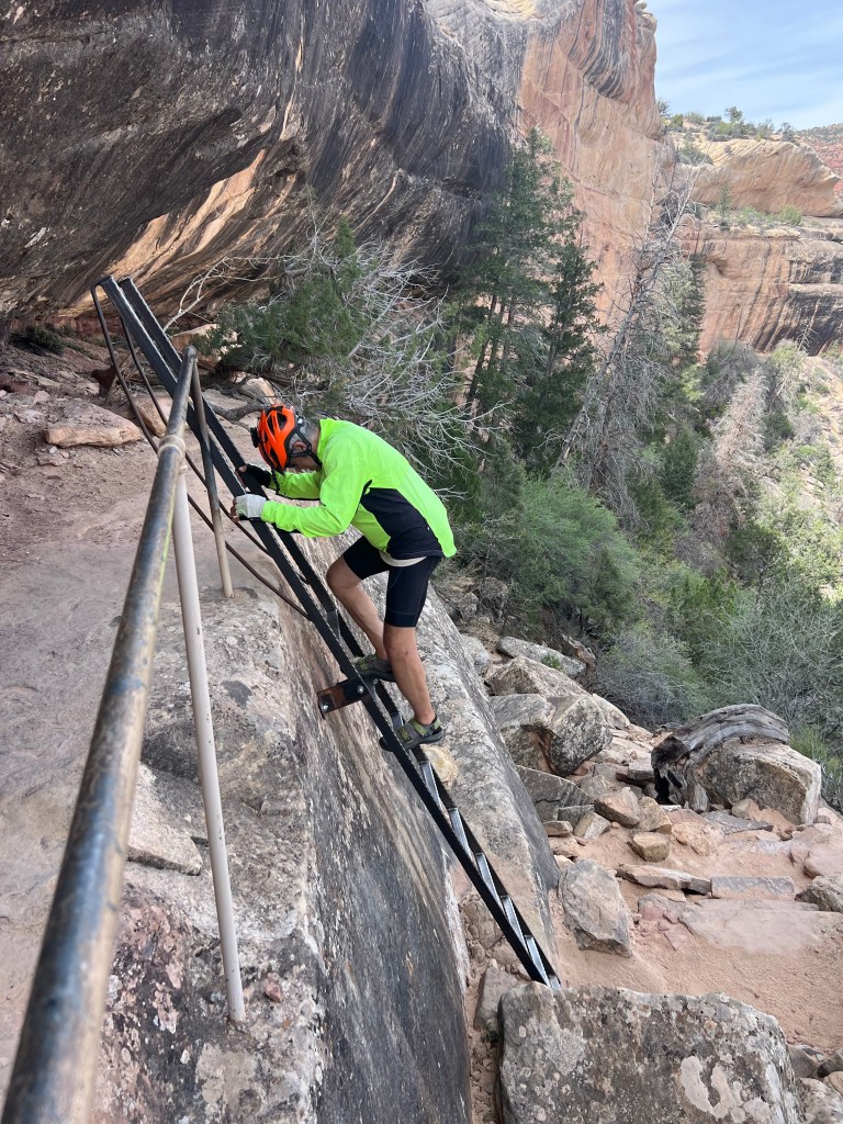
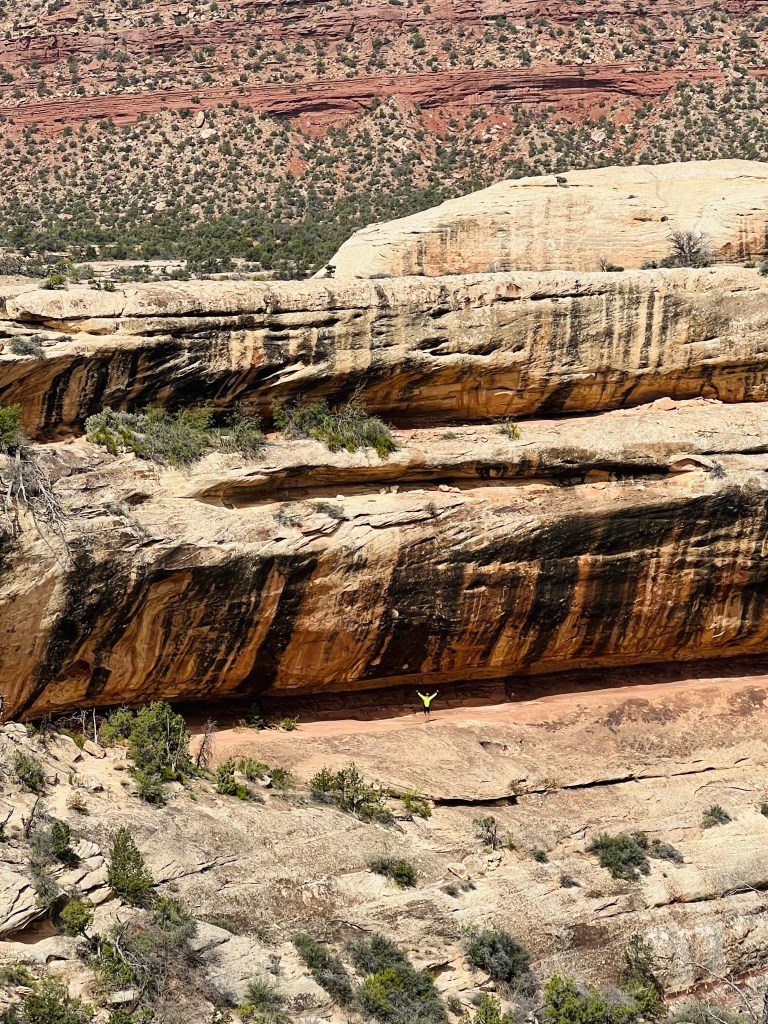
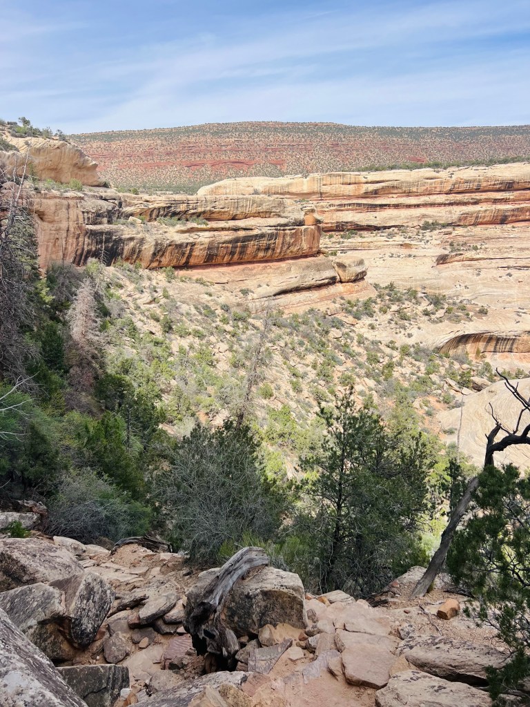
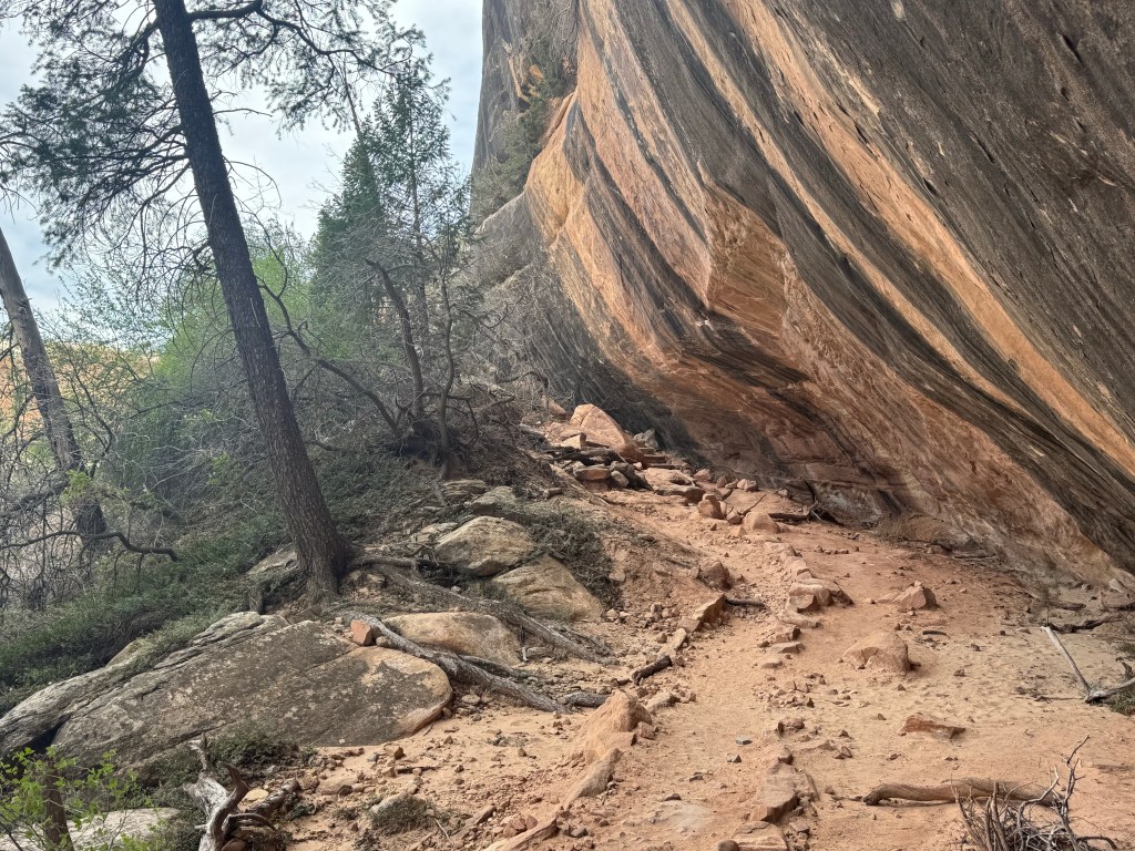
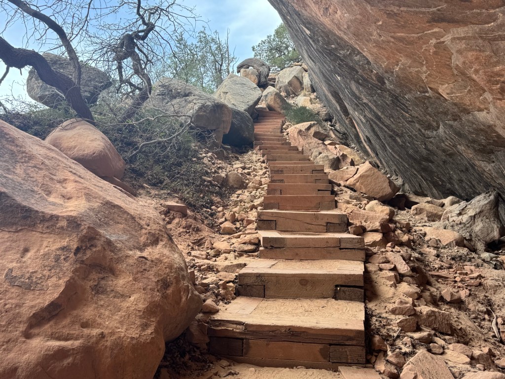
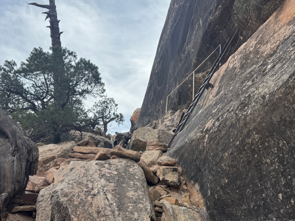
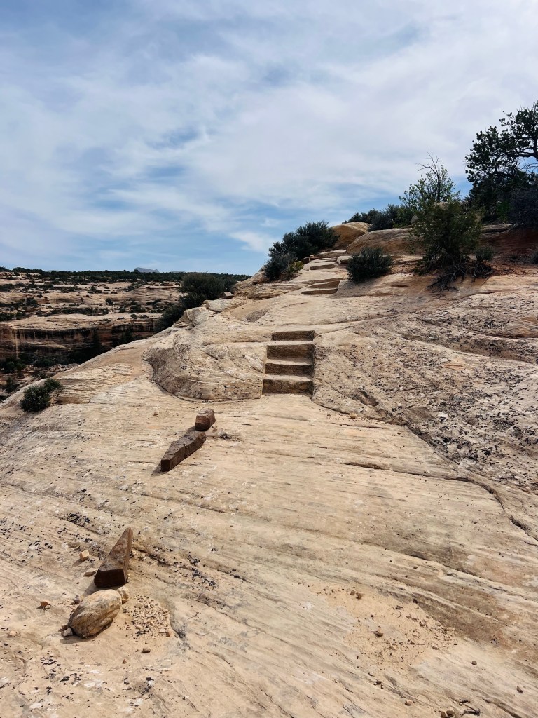
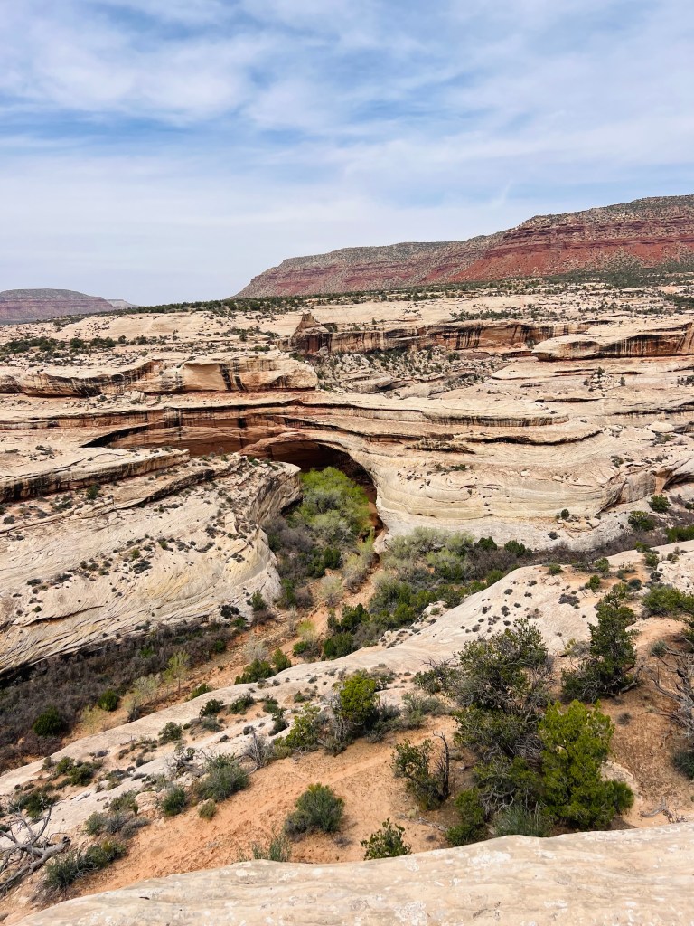
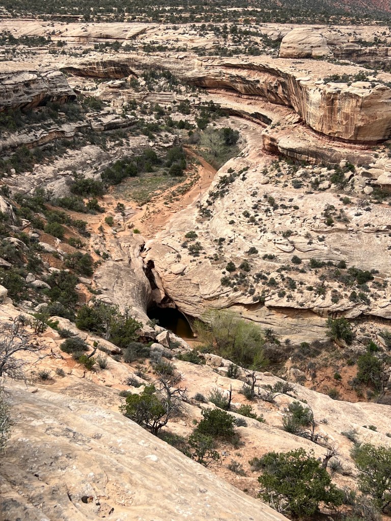
Sipapu Bridge and trail. There are 3 bridges inside the monument. You can take hikes to all of them from the overlooks and/or hike from bridge to bridge in the canyon.
Below is a couple of photos of the Sipapu Bridge.
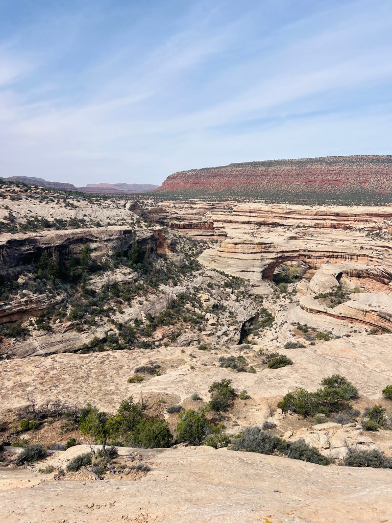
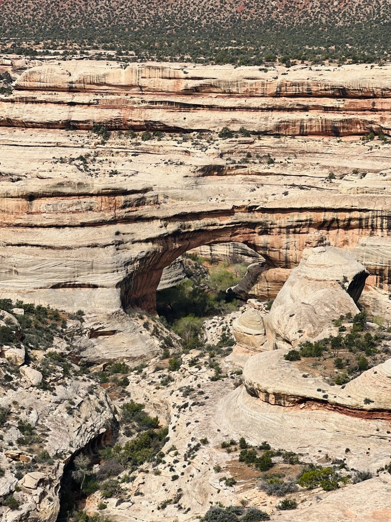
The next big pullout had a hike you could take down stairs and ladders to see the Sipapu Bridge and to hike to the bottom. We only went part way down on this trail
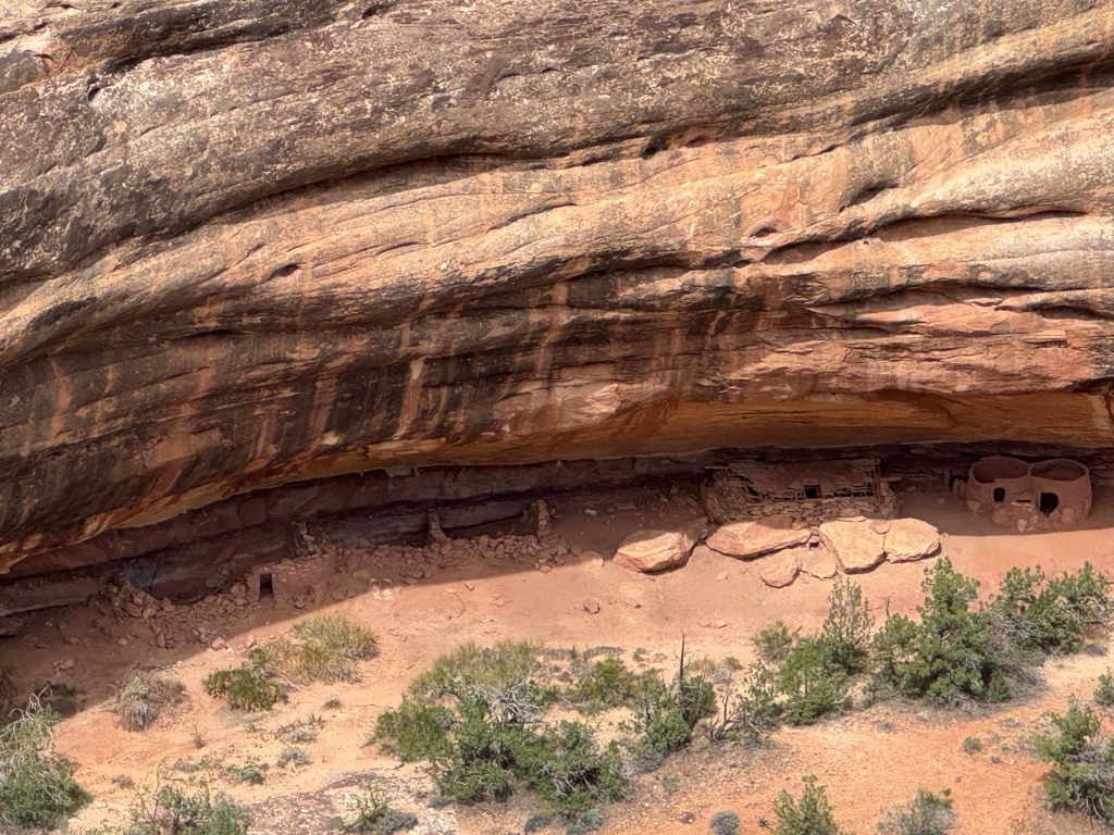
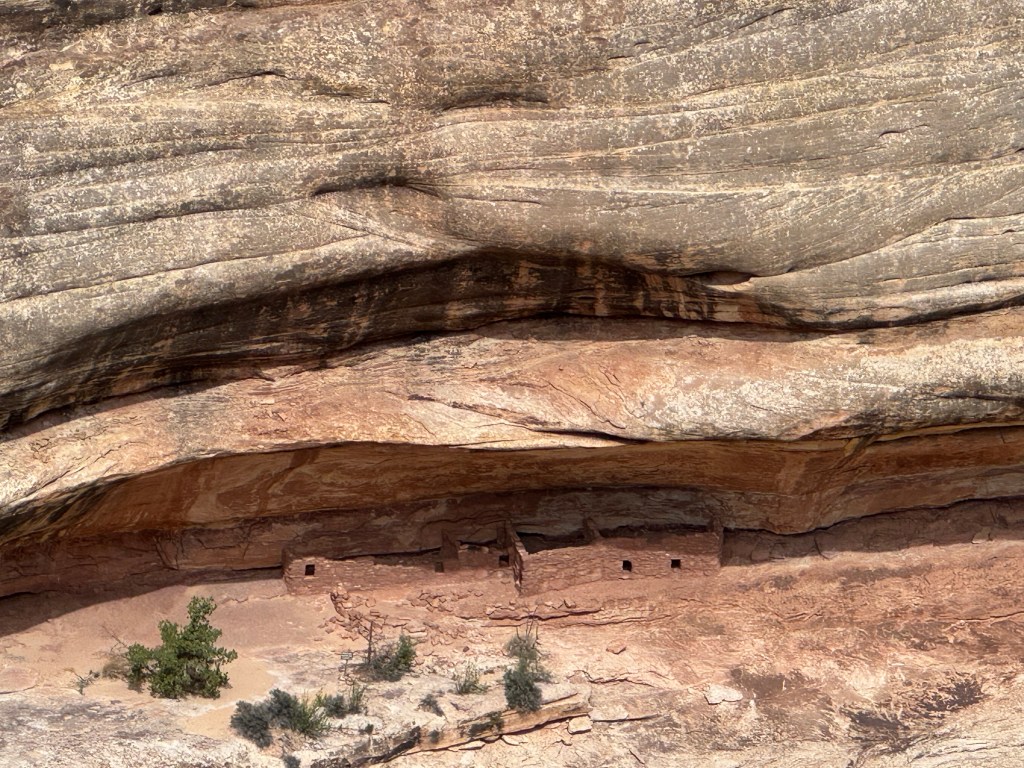
Horse collar homes. The next stop was an overlook to some cliff dwellings.
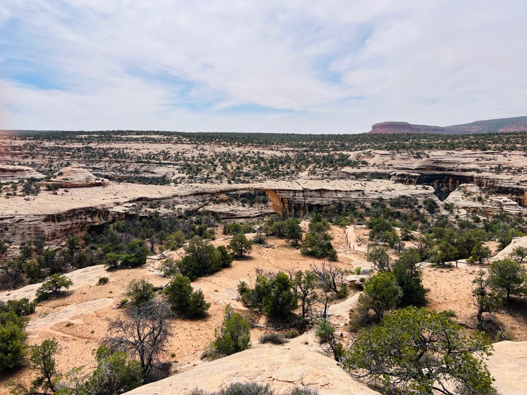
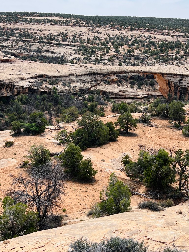
Kachina Bridge. The second bridge was next.
Owachoma Bridge. The third and final bridge is now just an arch. It is above any flowing water source now.
After the third bridge there were a few miles left in the loop. Mostly climbing at this point. Then the 3.5 miles climbing back to the van. Did I tell you the weather was cooler 60’s at the finish, but the wind was cross to headwind on the climb back. Going down was easy flying with downhill and a tailwind. Made for a good bike ride but we felt it when we finished riding.
The people you meet. We met so many nice people today. Idaho, Michigan… they will usually talk to you when you are traveling by bicycle. It’s nice when people are friendly.
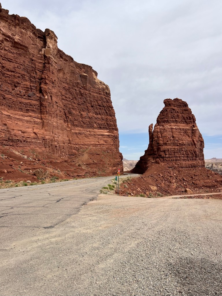
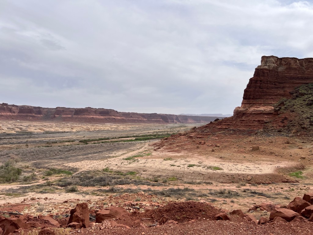
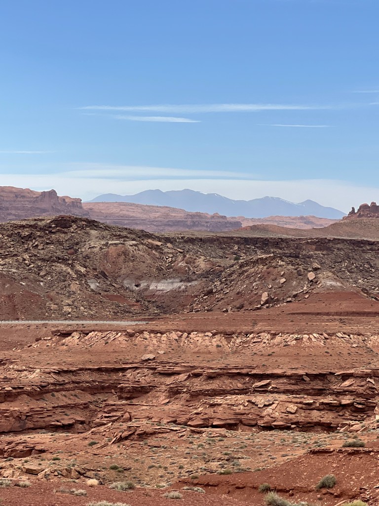
Drive to Torrey UT. Wait 10 miles or minutes and you see something else spectacular! We had a few hours to drive to Torrey UT where we were camping for two days. The drive headed mostly northwest to Hanksville then west to Torrey. But the landscapes we saw changed frequently.
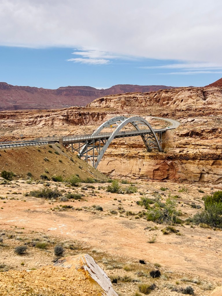
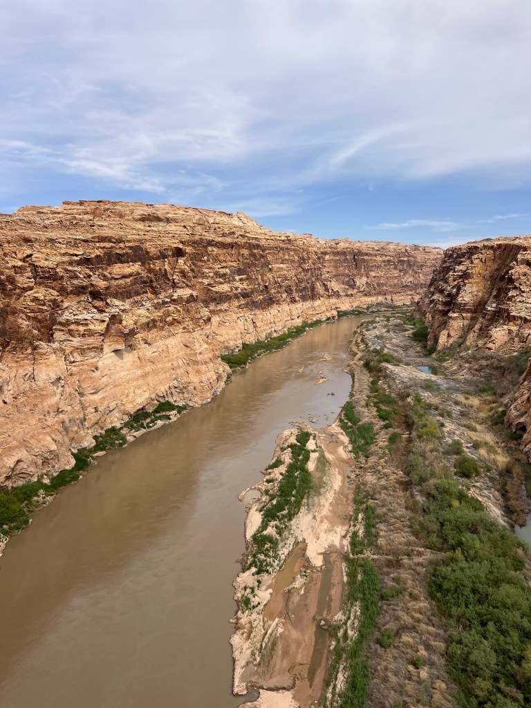
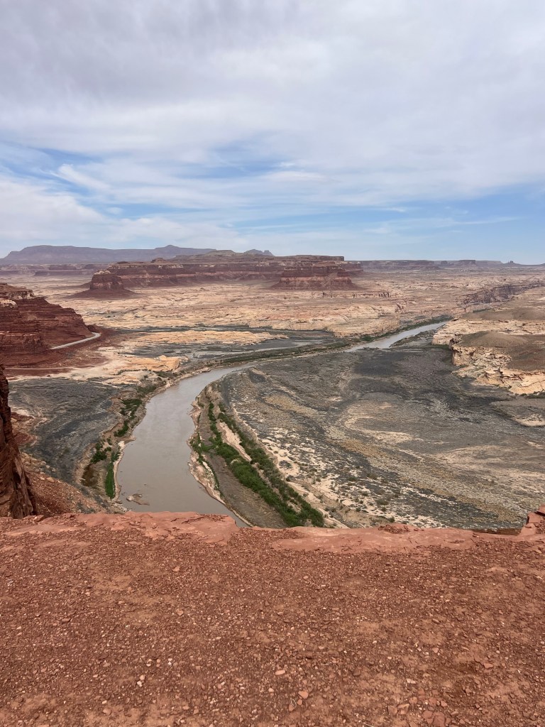
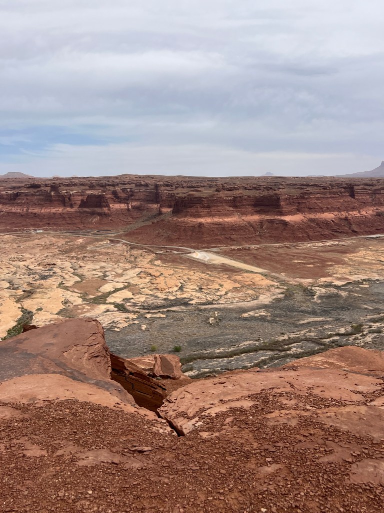
Colorado River to Lake Powell. First we crossed into the Glen Canyon National Recreation area and down to an area called Hite. Hite was a marina on Lake Powell. It’s where the Colorado becomes the lake. But the marina is high and dry and maybe has been since early 20000’s. Vegetation is growing where it used to be water. It’s a beautiful silvery green color.
Headed to Hanksville…Coming up and out of the Colorado River and headed north to Hanksville. Jim used to work for BLM in college summer when he was 21. He hasn’t been back since then. It’s not much to see… wasn’t then and isn’t now either. But it’s a memory. We needed gas so we had to stop. This week gas was $4.39.
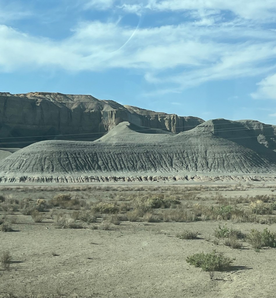
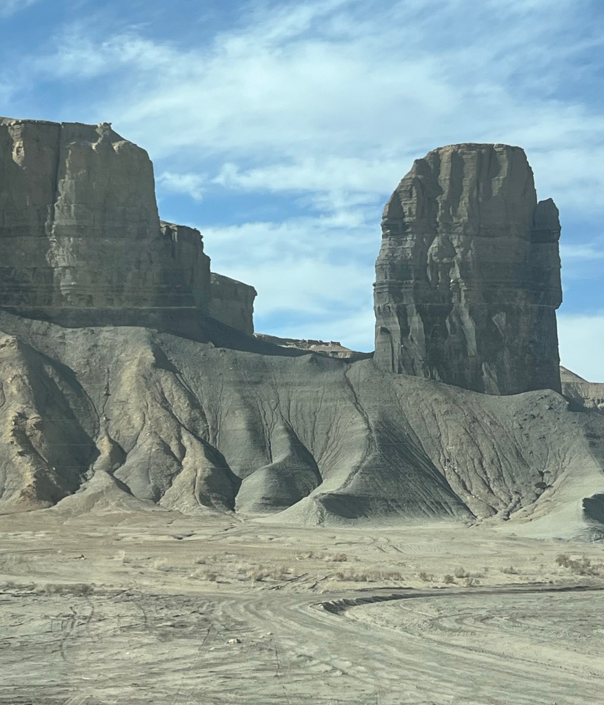
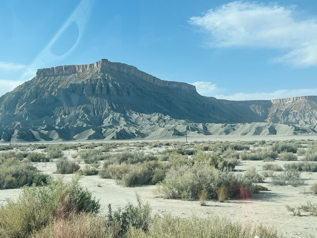
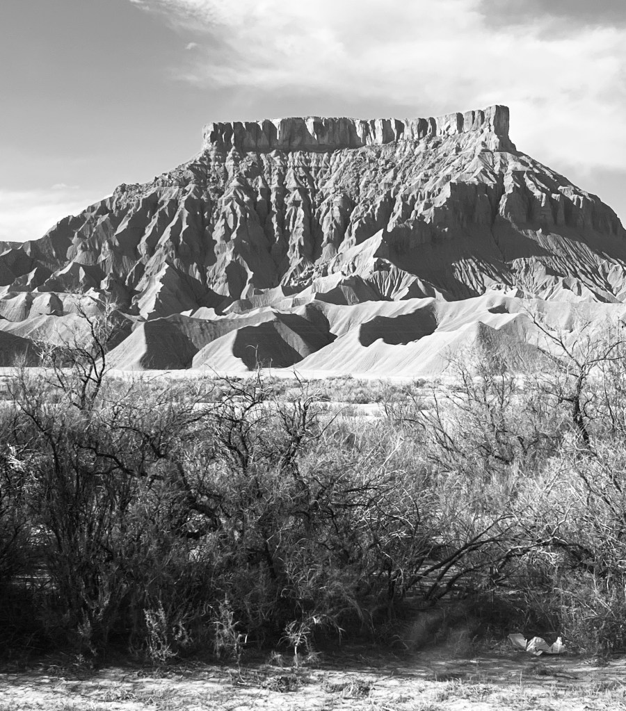
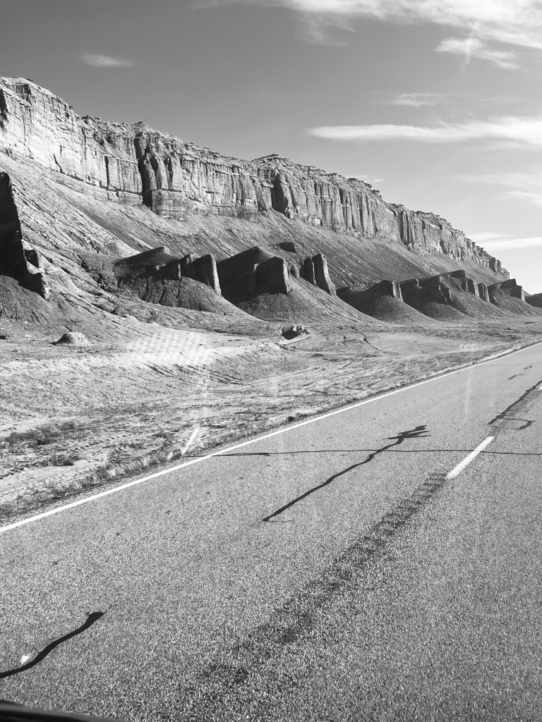
Moonscape … Swingarm City ORV playground. Wait 10 miles and it will change but I wasn’t expecting Mars. The hills changed from red and dark red sandstone to gray shale like concrete. If was eerie and beautiful all at the same time. It’s also an ORV (off road vehicle) playground like sand dunes. Dispersed campers everywhere in this dedicated playground
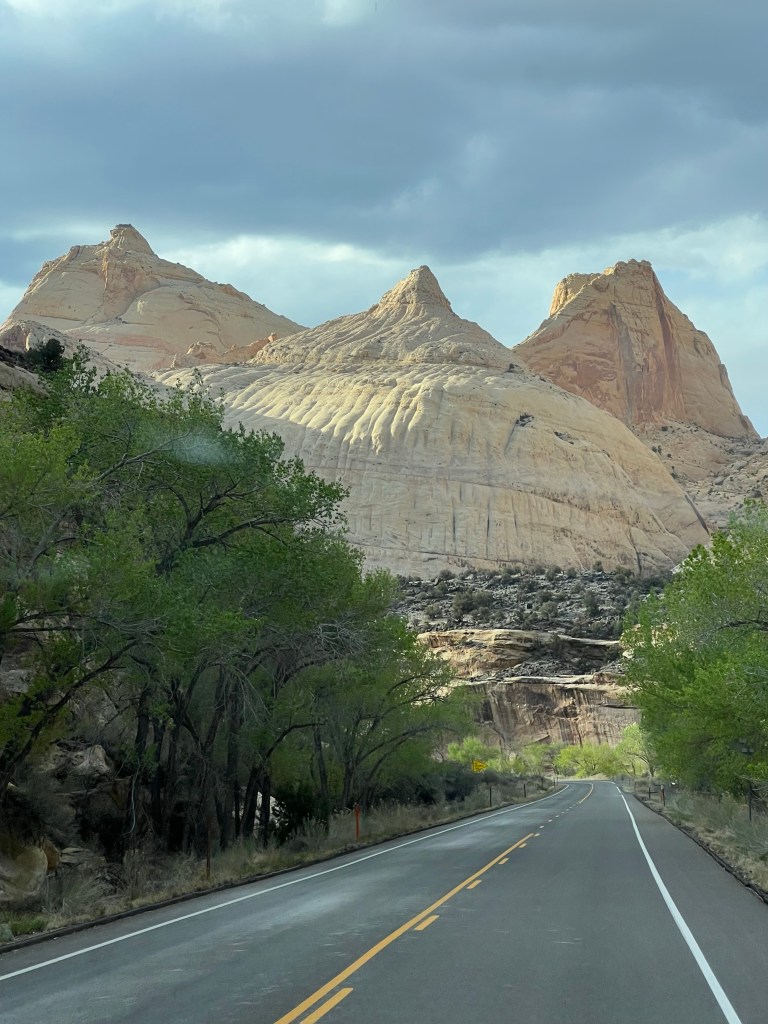
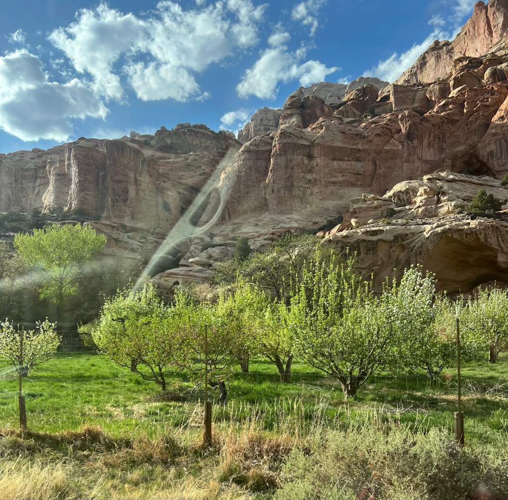
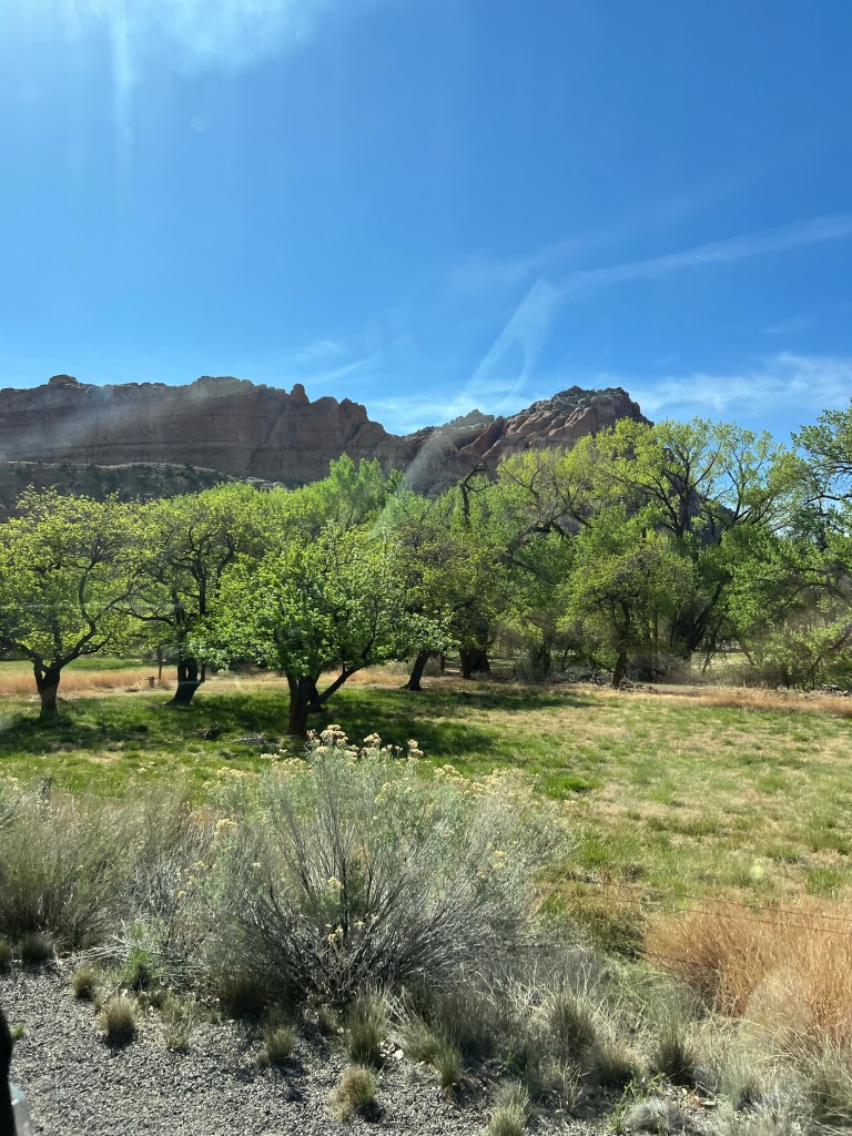
Quick trip through Capitol Reef National Park. To get to Torrey UT you drive through part of Capitol Reef. They have an old historic town called Fruita within it. There are actually fruit trees that they farm here and visitors can eat. It’s a small microclimate within the canyons of the park. We will visit more of the park tomorrow.
Torrey UT. Finally arrived at an RV park we reserved for two nights. Looking forward to a long hot shower! It’s been a few days with the outdoor shower. It’s okay (gets the dirt and sweat off) but a real one is better!

Amazing pictures and story telling Suzie. Thank you for sharing. What an adventure! I would love to look at these pictures with you so you could answer questions. I thought Jim was getting ready to have knee surgery?
Sincerely, Sheere Zupan
LikeLiked by 1 person
He is… end of August. Last hurrah 😊
LikeLike
Lake Powell is a dammed reservoir. I did once go on a houseboat with Park City friends and we may have taken off from that Marina. One of our nights on the lake we climbed up to native ruins. You climbed on the foot and hand holds like the people who lived there. I didn’t trust myself to climb down so I jumped off 18ft high into the water below. Now I guess it has gone back to a river like it was originally rather than a lake. I do recall making it a lake had many at odds back then. I think dams need to be removed now. They are antiquated as an energy source and they evaporate too much water. Paul and Jim would know the data now.
LikeLiked by 1 person
I also have many photos of the beautiful buttes around Fruita. I love th
LikeLiked by 1 person